Richterswil / Burghalde geodata
Richterswil / Burghalde (Zurich) is a section of populated place; located in Switzerland in Europe/Zurich (GMT+2) time zone. With population of 1,137 people, there are 1239 cities with bigger population in this country. Compared to other cities in Switzerland, 51.9% of cities are located further ↑North; 73.6% of cities are located further ←West and 64.2% of cities have lower elevation than Richterswil / Burghalde. Note1
Current local time in Richterswil / Burghalde:
06:19 AM, SaturdayDifference from your time zone: hours


Richterswil / Burghalde GPS coordinates[2]
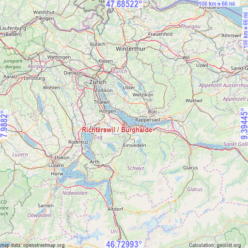
47° 12' 35.028" North, 8° 41' 28.788" East
| Map corner | latitude | longitude |
|---|---|---|
| Upper-left | 47.68522°, | 7.9882° |
| Center: | 47.20973°, | 8.69133° |
| Lower-right: | 46.72993°, | 9.39445° |
| Map W x H: | 106.2×106.2 km | = 66×66mi |
| max Lat: | 47.76737° ⇑51.9% North |
| Richterswil / Burghalde: | 47.20973° |
| min Lat: | ⇓48.1% South 45.83203° |
| min Long | Richterswil / B | max Long |
| 5.97153° | 8.69133° | 10.44624° |
| W 73.6%⇐ | ⇒26.4% E |
Elevation
Elevation of Richterswil / Burghalde is 542 m = 1778 ft, and this is 16.2 m = 53 ft below average elevation for this country.
| Max E: |
1845 m = 6053 ft | 35.8% |
| Avg. | 558.2 m = 1831 ft | |
| Richterswil / Burghalde | 542 m = 1778 ft | |
Min E: |
197 m = 646 ft | 64.2% |
See also: Switzerland elevation on elevation.city.
Geographical zone
Richterswil / Burghalde is located in North temperate zone (between Tropic of Cancer and the Arctic Circle). Distance of this North polar circle is 2151.9 km =1337.1 mi to North.| Distance of | km | miles | from Richterswil / Burghalde |
|---|---|---|---|
| North Pole | 4757.8 | 2956.4 | to North |
| Arctic Circle | 2151.9 | 1337.1 | to North |
| Tropic Cancer | 2643.3 | 1642.5 | to South |
| Equator | 5249.2 | 3261.7 | to South |


Nearby cities:
15 places around Richterswil / Burghalde: (largest is in red/bold)
• Bäch
3.2 km =2 mi,  101°
101°
• Männedorf / Ausserfeld
4.2 km =2.6 mi,  15°
15°
• Richterswil
0.6 km =0.4 mi,  133°
133°
• Richterswil / Dorfkern
1.1 km =0.7 mi, 104°
• Richterswil / Richterswil (Dorfkern)
1.3 km =0.8 mi,  124°
124°
• Samstagern
2.1 km =1.3 mi,  199°
199°
• Wollerau
2.7 km =1.7 mi, 128°
• Wädenswil
2.6 km =1.6 mi,  318°
318°
• Wädenswil / Boller-Giessen
1.4 km =0.9 mi,  336°
336°
• Wädenswil / Büelen
3.4 km =2.1 mi, 321°
• Wädenswil / Dorf (Wädenswil)
2.6 km =1.6 mi,  326°
326°
• Wädenswil / Eichweid
1.6 km =1 mi,  307°
307°
• Wädenswil / Hangenmoos
4 km =2.5 mi, 312°
• Wädenswil / Leihof-Mühlebach
2.2 km =1.4 mi, 315°
• Wädenswil / Untermosen-Fuhr
2.9 km =1.8 mi, 313°
Sources, notices
• [Note1] Compared only with cities in Switzerland existing in our database
• [Src1] Map data: © OpenStreetMap contributors (CC-BY-SA)
• [Src2] Other city data from geonames.org with taken over terms of usage.
• [Src3] Geographical zone / Annual Mean Temperature by Robert A. Rohde @ Wikipedia
