Thalwil / Süd geodata
Thalwil / Süd (Zurich) is a section of populated place; located in Switzerland in Europe/Zurich (GMT+2) time zone. With population of 1,255 people, there are 1162 cities with bigger population in this country. Compared to other cities in Switzerland, 56.5% of cities are located further ↓South; 63.1% of cities are located further ←West and 53.7% of cities have higher elevation than Thalwil / Süd. Note1


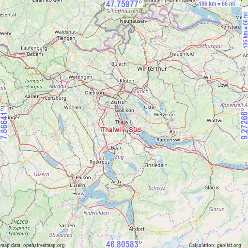
Thalwil / Süd GPS coordinates[2]
47° 17' 5.82" North, 8° 34' 10.344" East
| Map corner | latitude | longitude |
|---|---|---|
| Upper-left | 47.75977°, | 7.86641° |
| Center: | 47.28495°, | 8.56954° |
| Lower-right: | 46.80583°, | 9.27266° |
| Map W x H: | 106.1×106.1 km | = 65.9×65.9mi |
| max Lat: | 47.76737° ⇑43.5% North |
| Thalwil / Süd: | 47.28495° |
| min Lat: | ⇓56.5% South 45.83203° |
| min Long | Thalwil / Süd | max Long |
| 5.97153° | 8.56954° | 10.44624° |
| W 63.1%⇐ | ⇒36.9% E |
Elevation
Elevation of Thalwil / Süd is 470 m = 1542 ft, and this is 88.2 m = 289 ft below average elevation for this country.
| Max E: |
1845 m = 6053 ft | 53.7% |
| Avg. | 558.2 m = 1831 ft | |
| Thalwil / Süd | 470 m = 1542 ft | |
Min E: |
197 m = 646 ft | 46.3% |
See also: Switzerland elevation on elevation.city.
Geographical zone
Thalwil / Süd is located in North temperate zone (between Tropic of Cancer and the Arctic Circle). Distance of this North polar circle is 2143.6 km =1332 mi to North.| Distance of | km | miles | from Thalwil / Süd |
|---|---|---|---|
| North Pole | 4749.5 | 2951.2 | to North |
| Arctic Circle | 2143.6 | 1332 | to North |
| Tropic Cancer | 2651.7 | 1647.7 | to South |
| Equator | 5257.6 | 3266.9 | to South |


Nearby cities:
15 places around Thalwil / Süd: (largest is in red/bold)
• Erlenbach / links des Dorfbachs unterhalb Bahnlinie
2.6 km =1.6 mi,  47°
47°
• Gattikon
1.6 km =1 mi,  267°
267°
• Horgen / Scheller-Stockerstrasse
2.5 km =1.6 mi,  147°
147°
• Langnau / Langnau (Dorf)
2.5 km =1.6 mi, 273°
• Langnau am Albis
2.2 km =1.4 mi,  281°
281°
• Oberrieden
1.3 km =0.8 mi, 150°
• Oberrieden / Berg
1 km =0.6 mi,  166°
166°
• Oberrieden / Mitte
1.6 km =1 mi, 149°
• Oberrieden / See
1.5 km =0.9 mi,  139°
139°
• Rüschlikon / Alte Landstrasse
2.4 km =1.5 mi,  331°
331°
• Thalwil
0.9 km =0.6 mi, 328°
• Thalwil / Berg
1.3 km =0.8 mi,  306°
306°
• Thalwil / Dorfkern
0.7 km =0.4 mi,  338°
338°
• Thalwil / Nord
1.7 km =1.1 mi,  324°
324°
• Thalwil / See
1 km =0.6 mi,  358°
358°
Sources, notices
• [Note1] Compared only with cities in Switzerland existing in our database
• [Src1] Map data: © OpenStreetMap contributors (CC-BY-SA)
• [Src2] Other city data from geonames.org with taken over terms of usage.
• [Src3] Geographical zone / Annual Mean Temperature by Robert A. Rohde @ Wikipedia
