Pfäffikon / Pfäffikon (Dorfkern) geodata
Pfäffikon / Pfäffikon (Dorfkern) (Zurich) is a section of populated place; located in Switzerland in Europe/Zurich (GMT+2) time zone. With population of 5,595 people, there are 297 cities with bigger population in this country. Compared to other cities in Switzerland, 67.5% of cities are located further ↓South; 80.3% of cities are located further ←West and 65.6% of cities have lower elevation than Pfäffikon / Pfäffikon (Dorfkern). Note1
Current local time in Pfäffikon / Pfäffikon (Dorfkern):
08:56 AM, SaturdayDifference from your time zone: hours


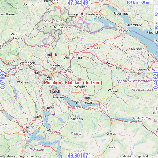
Pfäffikon / Pfäffikon (Dorfkern) GPS coordinates[2]
47° 22' 9.948" North, 8° 46' 59.124" East
| Map corner | latitude | longitude |
|---|---|---|
| Upper-left | 47.84349°, | 8.07996° |
| Center: | 47.36943°, | 8.78309° |
| Lower-right: | 46.89107°, | 9.48621° |
| Map W x H: | 105.9×105.9 km | = 65.8×65.8mi |
| max Lat: | 47.76737° ⇑32.5% North |
| Pfäffikon / Pfäffikon (Dorfkern): | 47.36943° |
| min Lat: | ⇓67.5% South 45.83203° |
| min Long | Pfäffikon / Pf | max Long |
| 5.97153° | 8.78309° | 10.44624° |
| W 80.3%⇐ | ⇒19.7% E |
Elevation
Elevation of Pfäffikon / Pfäffikon (Dorfkern) is 549 m = 1801 ft, and this is 9.2 m = 30 ft below average elevation for this country.
| Max E: |
1845 m = 6053 ft | 34.4% |
| Avg. | 558.2 m = 1831 ft | |
| Pfäffikon / Pfäffikon (Dorfkern) | 549 m = 1801 ft | |
Min E: |
197 m = 646 ft | 65.6% |
See also: Switzerland elevation on elevation.city.
Geographical zone
Pfäffikon / Pfäffikon (Dorfkern) is located in North temperate zone (between Tropic of Cancer and the Arctic Circle). Distance of this North polar circle is 2134.2 km =1326.1 mi to North.| Distance of | km | miles | from Pfäffikon / Pfäffikon (Dorfkern) |
|---|---|---|---|
| North Pole | 4740.1 | 2945.4 | to North |
| Arctic Circle | 2134.2 | 1326.1 | to North |
| Tropic Cancer | 2661.1 | 1653.5 | to South |
| Equator | 5267 | 3272.8 | to South |


Nearby cities:
15 places around Pfäffikon / Pfäffikon (Dorfkern): (largest is in red/bold)
• Fehraltorf
3.1 km =1.9 mi,  310°
310°
• Gutenswil
5.2 km =3.2 mi,  288°
288°
• Hittnau / Hittnau (Dorf)
3.2 km =2 mi,  102°
102°
• Oberhittnau
3.3 km =2.1 mi,  111°
111°
• Oberkempten
5.3 km =3.3 mi,  148°
148°
• Pfäffikon
0.9 km =0.6 mi,  129°
129°
• Pfäffikon / Irgenhausen
1.1 km =0.7 mi,  137°
137°
• Russikon
3.1 km =1.9 mi,  348°
348°
• Uster / Ober-Uster
4.4 km =2.7 mi,  238°
238°
• Wermatswil
3.2 km =2 mi,  259°
259°
• Wetzikon
4.9 km =3 mi,  166°
166°
• Wetzikon / Kempten
4.5 km =2.8 mi, 153°
• Wetzikon / Ober-Wetzikon
5.1 km =3.2 mi, 165°
• Wetzikon / Robenhausen
4.3 km =2.7 mi,  175°
175°
• Widum
4.6 km =2.9 mi, 171°
Sources, notices
• [Note1] Compared only with cities in Switzerland existing in our database
• [Src1] Map data: © OpenStreetMap contributors (CC-BY-SA)
• [Src2] Other city data from geonames.org with taken over terms of usage.
• [Src3] Geographical zone / Annual Mean Temperature by Robert A. Rohde @ Wikipedia
