Wermatswil geodata
Wermatswil (Zurich) is a populated place; located in Switzerland in Europe/Zurich (GMT+2) time zone. With population of 774 people, there are 1512 cities with bigger population in this country. Compared to other cities in Switzerland, 66.6% of cities are located further ↓South; 77.7% of cities are located further ←West and 67.6% of cities have lower elevation than Wermatswil. Note1


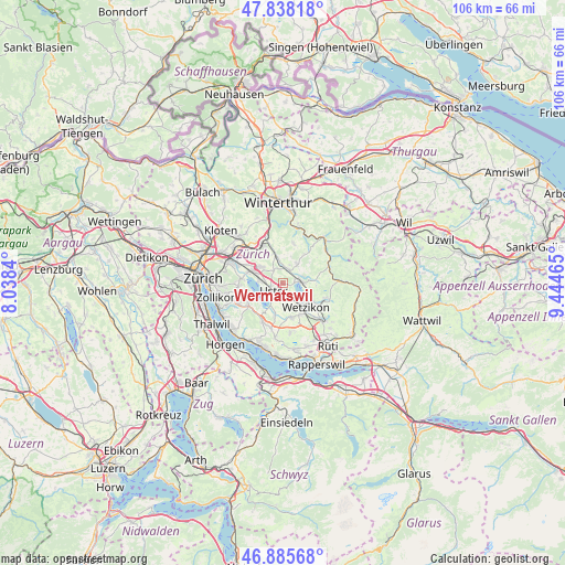
Wermatswil GPS coordinates[2]
47° 21' 50.688" North, 8° 44' 29.472" East
| Map corner | latitude | longitude |
|---|---|---|
| Upper-left | 47.83818°, | 8.0384° |
| Center: | 47.36408°, | 8.74152° |
| Lower-right: | 46.88568°, | 9.44465° |
| Map W x H: | 105.9×105.9 km | = 65.8×65.8mi |
| max Lat: | 47.76737° ⇑33.4% North |
| Wermatswil: | 47.36408° |
| min Lat: | ⇓66.6% South 45.83203° |
| min Long | Wermatswil | max Long |
| 5.97153° | 8.74152° | 10.44624° |
| W 77.7%⇐ | ⇒22.3% E |
Elevation
Elevation of Wermatswil is 559 m = 1834 ft, and this is 0.79999999999995 m = 3 ft above average elevation for this country.
| Max E: |
1845 m = 6053 ft | 32.4% |
| Wermatswil | 559 m 1834 ft | |
| Avg. | 558.2 m = 1831 ft | |
Min E: |
197 m = 646 ft | 67.6% |
See also: Switzerland elevation on elevation.city.
Geographical zone
Wermatswil is located in North temperate zone (between Tropic of Cancer and the Arctic Circle). Distance of this North polar circle is 2134.8 km =1326.5 mi to North.| Distance of | km | miles | from Wermatswil |
|---|---|---|---|
| North Pole | 4740.7 | 2945.7 | to North |
| Arctic Circle | 2134.8 | 1326.5 | to North |
| Tropic Cancer | 2660.5 | 1653.2 | to South |
| Equator | 5266.4 | 3272.4 | to South |


Nearby cities:
15 places around Wermatswil: (largest is in red/bold)
• Fehraltorf
2.7 km =1.7 mi,  15°
15°
• Greifensee / Pfisterhölzli
3.9 km =2.4 mi,  270°
270°
• Gutenswil
2.8 km =1.7 mi,  320°
320°
• Nänikon
4 km =2.5 mi,  279°
279°
• Nänikon / Nänikon (Dorfkern)
3.8 km =2.4 mi, 281°
• Pfäffikon
3.8 km =2.4 mi,  89°
89°
• Pfäffikon / Irgenhausen
3.9 km =2.4 mi, 92°
• Pfäffikon / Pfäffikon (Dorfkern)
3.2 km =2 mi,  79°
79°
• Riedikon
4.2 km =2.6 mi,  211°
211°
• Uster
2.4 km =1.5 mi,  219°
219°
• Uster / Gschwader
2.1 km =1.3 mi,  258°
258°
• Uster / Kirch-Uster
2.7 km =1.7 mi, 220°
• Uster / Nieder-Uster
3.6 km =2.2 mi,  238°
238°
• Uster / Nossikon
2.8 km =1.7 mi, 205°
• Uster / Ober-Uster
1.8 km =1.1 mi,  200°
200°
Sources, notices
• [Note1] Compared only with cities in Switzerland existing in our database
• [Src1] Map data: © OpenStreetMap contributors (CC-BY-SA)
• [Src2] Other city data from geonames.org with taken over terms of usage.
• [Src3] Geographical zone / Annual Mean Temperature by Robert A. Rohde @ Wikipedia
