Uster / Ober-Uster geodata
Uster / Ober-Uster (Zurich) is a section of populated place; located in Switzerland in Europe/Zurich (GMT+2) time zone. With population of 5,100 people, there are 333 cities with bigger population in this country. Compared to other cities in Switzerland, 64.4% of cities are located further ↓South; 77.3% of cities are located further ←West and 56.2% of cities have lower elevation than Uster / Ober-Uster. Note1


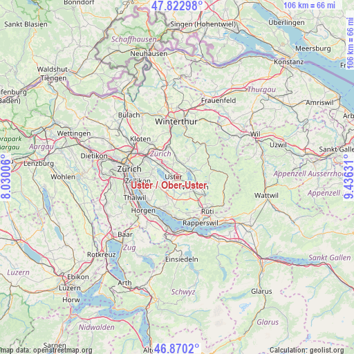
Uster / Ober-Uster GPS coordinates[2]
47° 20' 55.464" North, 8° 43' 59.484" East
| Map corner | latitude | longitude |
|---|---|---|
| Upper-left | 47.82298°, | 8.03006° |
| Center: | 47.34874°, | 8.73319° |
| Lower-right: | 46.8702°, | 9.43631° |
| Map W x H: | 105.9×105.9 km | = 65.8×65.8mi |
| max Lat: | 47.76737° ⇑35.6% North |
| Uster / Ober-Uster: | 47.34874° |
| min Lat: | ⇓64.4% South 45.83203° |
| min Long | Uster / Ober-Us | max Long |
| 5.97153° | 8.73319° | 10.44624° |
| W 77.3%⇐ | ⇒22.7% E |
Elevation
Elevation of Uster / Ober-Uster is 502 m = 1647 ft, and this is 56.2 m = 184 ft below average elevation for this country.
| Max E: |
1845 m = 6053 ft | 43.8% |
| Avg. | 558.2 m = 1831 ft | |
| Uster / Ober-Uster | 502 m = 1647 ft | |
Min E: |
197 m = 646 ft | 56.2% |
See also: Switzerland elevation on elevation.city.
Geographical zone
Uster / Ober-Uster is located in North temperate zone (between Tropic of Cancer and the Arctic Circle). Distance of this North polar circle is 2136.5 km =1327.6 mi to North.| Distance of | km | miles | from Uster / Ober-Uster |
|---|---|---|---|
| North Pole | 4742.4 | 2946.8 | to North |
| Arctic Circle | 2136.5 | 1327.6 | to North |
| Tropic Cancer | 2658.8 | 1652.1 | to South |
| Equator | 5264.7 | 3271.3 | to South |


Nearby cities:
15 places around Uster / Ober-Uster: (largest is in red/bold)
• Bertschikon
3.7 km =2.3 mi,  149°
149°
• Greifensee
4.4 km =2.7 mi,  297°
297°
• Greifensee / Pfisterhölzli
3.7 km =2.3 mi, 297°
• Gutenswil
4.1 km =2.5 mi,  343°
343°
• Mönchaltorf / Hohfurren
3.9 km =2.4 mi,  196°
196°
• Nänikon
4.1 km =2.5 mi,  305°
305°
• Nänikon / Nänikon (Dorfkern)
3.9 km =2.4 mi, 308°
• Pfäffikon / Pfäffikon (Dorfkern)
4.4 km =2.7 mi,  58°
58°
• Riedikon
2.4 km =1.5 mi,  219°
219°
• Uster
0.9 km =0.6 mi,  259°
259°
• Uster / Gschwader
1.9 km =1.2 mi, 311°
• Uster / Kirch-Uster
1.2 km =0.7 mi,  253°
253°
• Uster / Nieder-Uster
2.4 km =1.5 mi,  266°
266°
• Uster / Nossikon
1 km =0.6 mi,  213°
213°
• Wermatswil
1.8 km =1.1 mi,  20°
20°
Sources, notices
• [Note1] Compared only with cities in Switzerland existing in our database
• [Src1] Map data: © OpenStreetMap contributors (CC-BY-SA)
• [Src2] Other city data from geonames.org with taken over terms of usage.
• [Src3] Geographical zone / Annual Mean Temperature by Robert A. Rohde @ Wikipedia
