Sulz geodata
Sulz (Zurich) is a populated place; located in Switzerland in Europe/Zurich (GMT+2) time zone. With population of 1,244 people, there are 1168 cities with bigger population in this country. Compared to other cities in Switzerland, 94.1% of cities are located further ↓South; 80.6% of cities are located further ←West and 59.8% of cities have higher elevation than Sulz. Note1


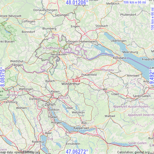
Sulz GPS coordinates[2]
47° 32' 22.344" North, 8° 47' 19.932" East
| Map corner | latitude | longitude |
|---|---|---|
| Upper-left | 48.01206°, | 8.08575° |
| Center: | 47.53954°, | 8.78887° |
| Lower-right: | 47.06272°, | 9.492° |
| Map W x H: | 105.6×105.6 km | = 65.6×65.6mi |
| max Lat: | 47.76737° ⇑5.9% North |
| Sulz: | 47.53954° |
| min Lat: | ⇓94.1% South 45.83203° |
| min Long | Sulz | max Long |
| 5.97153° | 8.78887° | 10.44624° |
| W 80.6%⇐ | ⇒19.4% E |
Elevation
Elevation of Sulz is 455 m = 1493 ft, and this is 103.2 m = 339 ft below average elevation for this country.
| Max E: |
1845 m = 6053 ft | 59.8% |
| Avg. | 558.2 m = 1831 ft | |
| Sulz | 455 m = 1493 ft | |
Min E: |
197 m = 646 ft | 40.2% |
See also: Switzerland elevation on elevation.city.
Geographical zone
Sulz is located in North temperate zone (between Tropic of Cancer and the Arctic Circle). Distance of this North polar circle is 2115.3 km =1314.4 mi to North.| Distance of | km | miles | from Sulz |
|---|---|---|---|
| North Pole | 4721.2 | 2933.6 | to North |
| Arctic Circle | 2115.3 | 1314.4 | to North |
| Tropic Cancer | 2680 | 1665.3 | to South |
| Equator | 5285.9 | 3284.5 | to South |


Nearby cities:
15 places around Sulz: (largest is in red/bold)
• Dinhard
2.4 km =1.5 mi,  316°
316°
• Elsau-Räterschen
4.2 km =2.6 mi,  169°
169°
• Oberwinterthur (Kreis 2)
2.9 km =1.8 mi,  211°
211°
• Oberwinterthur (Kreis 2) / Guggenbühl
3.6 km =2.2 mi,  216°
216°
• Oberwinterthur (Kreis 2) / Hegi
3.9 km =2.4 mi,  200°
200°
• Oberwinterthur (Kreis 2) / Hegmatten
3.8 km =2.4 mi, 210°
• Oberwinterthur (Kreis 2) / Zinzikon
3.3 km =2.1 mi,  227°
227°
• Rickenbach
1.5 km =0.9 mi,  22°
22°
• Rümikon
4.1 km =2.5 mi,  181°
181°
• Seuzach / Seuzach (Dorf)
3.9 km =2.4 mi,  263°
263°
• Seuzach Dorf
4.3 km =2.7 mi, 264°
• Seuzach Dorf / Brandbüel
3.6 km =2.2 mi, 264°
• Seuzach Dorf / Breite-Weid
4.2 km =2.6 mi, 260°
• Wiesendangen / Steinegg
1.4 km =0.9 mi, 201°
• Wiesendangen / Wiesendangen (Dorf)
2 km =1.2 mi, 178°
Sources, notices
• [Note1] Compared only with cities in Switzerland existing in our database
• [Src1] Map data: © OpenStreetMap contributors (CC-BY-SA)
• [Src2] Other city data from geonames.org with taken over terms of usage.
• [Src3] Geographical zone / Annual Mean Temperature by Robert A. Rohde @ Wikipedia
