Quillota geodata
Quillota (Valparaíso) is a seat of a second-order administrative division; located in Chile in America/Santiago (GMT-4) time zone. With population of 67,779 people, there are 33 cities with bigger population in this country. Compared to other cities in Chile, 80.7% of cities are located further ↓South; 62.8% of cities are located further ←West and 52.4% of cities have higher elevation than Quillota. Note1


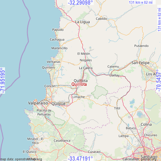
Quillota GPS coordinates[2]
32° 53' 0.276" South, 71° 14' 55.752" West
| Map corner | latitude | longitude |
|---|---|---|
| Upper-left | -32.29098°, | -71.95195° |
| Center: | -32.88341°, | -71.24882° |
| Lower-right: | -33.47191°, | -70.5457° |
| Map W x H: | 131.3×131.3 km | = 81.6×81.6mi |
| max Lat: | -18.19821° ⇑19.3% North |
| Quillota: | -32.88341° |
| min Lat: | ⇓80.7% South -54.93355° |
| min Long | Quillota | max Long |
| -109.42438° | -71.24882° | -67.60963° |
| W 62.8%⇐ | ⇒37.2% E |
Elevation
Elevation of Quillota is 128 m = 420 ft, and this is 145 m = 476 ft below average elevation for this country.
| Max E: |
3544 m = 11627 ft | 52.4% |
| Avg. | 273 m = 896 ft | |
| Quillota | 128 m = 420 ft | |
Min E: |
1 m = 3 ft | 47.6% |
See also: Quillota elevation on elevation.city.
Geographical zone
Quillota is located in South temperate zone (between Tropic of Capricorn and the Antarctic Circle). Distance of this Southern Tropic circle is 1050.4 km =652.7 mi to North.| Distance of | km | miles | from Quillota |
|---|---|---|---|
| Equator | 3656.3 | 2271.9 | to North |
| Tropic Capricorn | 1050.4 | 652.7 | to North |
| Antarctic Circle | 3744.9 | 2327 | to South |
| South Pole | 6350.8 | 3946.2 | to South |


Nearby cities:
15 places around Quillota: (largest is in red/bold)
• Chicureo Abajo
71.1 km =44.2 mi,  128°
128°
• Colina
64.3 km =40 mi,  123°
123°
• El Tabo
74 km =46 mi,  211°
211°
• Hacienda La Calera
11.5 km =7.1 mi,  15°
15°
• La Ligua
48 km =29.8 mi,  1°
1°
• Lampa
56.7 km =35.2 mi,  142°
142°
• Limache
14.9 km =9.3 mi,  186°
186°
• Llaillay
27.7 km =17.2 mi,  80°
80°
• Lo Prado
79.1 km =49.2 mi, 142°
• Los Andes
61 km =37.9 mi, 84°
• Quilpué
25.7 km =16 mi,  224°
224°
• San Felipe
51.1 km =31.8 mi,  73°
73°
• Valparaíso
39.4 km =24.5 mi,  244°
244°
• Villa Alemana
21.1 km =13.1 mi, 213°
• Viña del Mar
32.3 km =20.1 mi, 240°
Sources, notices
• [Note1] Compared only with cities in Chile existing in our database
• [Src1] Map data: © OpenStreetMap contributors (CC-BY-SA)
• [Src2] Other city data from geonames.org with taken over terms of usage.
• [Src3] Geographical zone / Annual Mean Temperature by Robert A. Rohde @ Wikipedia
