Quilpué geodata
Quilpué (Valparaíso) is a seat of a second-order administrative division; located in Chile in America/Santiago (GMT-4) time zone. With population of 130,263 people, there are 21 cities with bigger population in this country. Compared to other cities in Chile, 77.2% of cities are located further ↓South; 56.6% of cities are located further ←West and 55.2% of cities have higher elevation than Quilpué. Note1


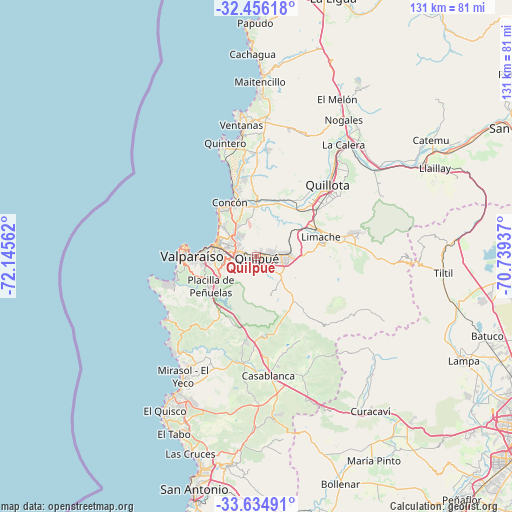
Quilpué GPS coordinates[2]
33° 2' 51.072" South, 71° 26' 32.964" West
| Map corner | latitude | longitude |
|---|---|---|
| Upper-left | -32.45618°, | -72.14562° |
| Center: | -33.04752°, | -71.44249° |
| Lower-right: | -33.63491°, | -70.73937° |
| Map W x H: | 131.1×131.1 km | = 81.5×81.5mi |
| max Lat: | -18.19821° ⇑22.8% North |
| Quilpué: | -33.04752° |
| min Lat: | ⇓77.2% South -54.93355° |
| min Long | Quilpué | max Long |
| -109.42438° | -71.44249° | -67.60963° |
| W 56.6%⇐ | ⇒43.4% E |
Elevation
Elevation of Quilpué is 113 m = 371 ft, and this is 160 m = 525 ft below average elevation for this country.
| Max E: |
3544 m = 11627 ft | 55.2% |
| Avg. | 273 m = 896 ft | |
| Quilpué | 113 m = 371 ft | |
Min E: |
1 m = 3 ft | 44.8% |
See also: Quilpué elevation on elevation.city.
Geographical zone
Quilpué is located in South temperate zone (between Tropic of Capricorn and the Antarctic Circle). Distance of this Southern Tropic circle is 1068.6 km =664 mi to North.| Distance of | km | miles | from Quilpué |
|---|---|---|---|
| Equator | 3674.5 | 2283.2 | to North |
| Tropic Capricorn | 1068.6 | 664 | to North |
| Antarctic Circle | 3726.6 | 2315.6 | to South |
| South Pole | 6332.5 | 3934.8 | to South |


Nearby cities:
15 places around Quilpué: (largest is in red/bold)
• Cartagena
58.4 km =36.3 mi,  195°
195°
• Colina
73.6 km =45.7 mi,  103°
103°
• El Tabo
49.4 km =30.7 mi, 204°
• Hacienda La Calera
36.2 km =22.5 mi,  35°
35°
• La Ligua
69.1 km =42.9 mi,  16°
16°
• Lampa
59.1 km =36.7 mi,  116°
116°
• Limache
16.7 km =10.4 mi,  78°
78°
• Llaillay
50.9 km =31.6 mi,  63°
63°
• Melipilla
74.4 km =46.2 mi,  163°
163°
• Quillota
25.7 km =16 mi, 44°
• San Antonio
62.7 km =39 mi,  194°
194°
• San Felipe
74.6 km =46.4 mi, 63°
• Valparaíso
17.5 km =10.9 mi,  274°
274°
• Villa Alemana
6.5 km =4 mi, 84°
• Viña del Mar
10.5 km =6.5 mi,  284°
284°
Sources, notices
• [Note1] Compared only with cities in Chile existing in our database
• [Src1] Map data: © OpenStreetMap contributors (CC-BY-SA)
• [Src2] Other city data from geonames.org with taken over terms of usage.
• [Src3] Geographical zone / Annual Mean Temperature by Robert A. Rohde @ Wikipedia
