Villa Alemana geodata
Villa Alemana (Valparaíso) is a seat of a third-order administrative division; located in Chile in America/Santiago (GMT-4) time zone. With population of 97,320 people, there are 27 cities with bigger population in this country. Compared to other cities in Chile, 77.9% of cities are located further ↓South; 57.9% of cities are located further ←West and 53.1% of cities have lower elevation than Villa Alemana. Note1
Administrative division(s):
- Level 1: Valparaíso
- Level 2: Provincia de Marga Marga
- Level 3: Villa Alemana


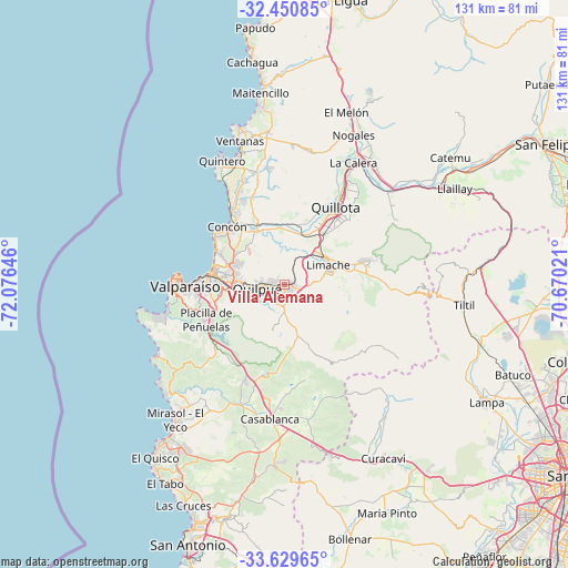
Villa Alemana GPS coordinates[2]
33° 2' 31.992" South, 71° 22' 23.988" West
| Map corner | latitude | longitude |
|---|---|---|
| Upper-left | -32.45085°, | -72.07646° |
| Center: | -33.04222°, | -71.37333° |
| Lower-right: | -33.62965°, | -70.67021° |
| Map W x H: | 131.1×131.1 km | = 81.5×81.5mi |
| max Lat: | -18.19821° ⇑22.1% North |
| Villa Alemana: | -33.04222° |
| min Lat: | ⇓77.9% South -54.93355° |
| min Long | Villa Alemana | max Long |
| -109.42438° | -71.37333° | -67.60963° |
| W 57.9%⇐ | ⇒42.1% E |
Elevation
Elevation of Villa Alemana is 147 m = 482 ft, and this is 126 m = 413 ft below average elevation for this country.
| Max E: |
3544 m = 11627 ft | 46.9% |
| Avg. | 273 m = 896 ft | |
| Villa Alemana | 147 m = 482 ft | |
Min E: |
1 m = 3 ft | 53.1% |
See also: Villa Alemana elevation on elevation.city.
Geographical zone
Villa Alemana is located in South temperate zone (between Tropic of Capricorn and the Antarctic Circle). Distance of this Southern Tropic circle is 1068 km =663.6 mi to North.| Distance of | km | miles | from Villa Alemana |
|---|---|---|---|
| Equator | 3674 | 2282.9 | to North |
| Tropic Capricorn | 1068 | 663.6 | to North |
| Antarctic Circle | 3727.2 | 2316 | to South |
| South Pole | 6333.1 | 3935.2 | to South |


Nearby cities:
15 places around Villa Alemana: (largest is in red/bold)
• Cartagena
60.9 km =37.8 mi,  200°
200°
• Chicureo Abajo
72.2 km =44.9 mi,  111°
111°
• Colina
67.5 km =41.9 mi, 105°
• El Tabo
52.9 km =32.9 mi,  211°
211°
• Hacienda La Calera
32.3 km =20.1 mi,  26°
26°
• La Ligua
66.9 km =41.6 mi,  11°
11°
• Lampa
53.7 km =33.4 mi,  120°
120°
• Limache
10.3 km =6.4 mi,  74°
74°
• Llaillay
44.9 km =27.9 mi,  60°
60°
• Quillota
21.1 km =13.1 mi, 33°
• Quilpué
6.5 km =4 mi,  264°
264°
• San Antonio
65.2 km =40.5 mi, 199°
• San Felipe
68.6 km =42.6 mi, 61°
• Valparaíso
23.9 km =14.9 mi,  271°
271°
• Viña del Mar
16.8 km =10.4 mi,  276°
276°
Sources, notices
• [Note1] Compared only with cities in Chile existing in our database
• [Src1] Map data: © OpenStreetMap contributors (CC-BY-SA)
• [Src2] Other city data from geonames.org with taken over terms of usage.
• [Src3] Geographical zone / Annual Mean Temperature by Robert A. Rohde @ Wikipedia
