Lampa geodata
Lampa (Santiago Metropolitan) is a populated place; located in Chile in America/Santiago (GMT-4) time zone. With population of 29,250 people, there are 59 cities with bigger population in this country. Compared to other cities in Chile, 75.2% of cities are located further ↓South; 75.2% of cities are located further ←West and 84.8% of cities have lower elevation than Lampa. Note1
Administrative division(s):
- Level 1: Santiago Metropolitan
- Level 2: Provincia de Chacabuco
- Level 3: Lampa


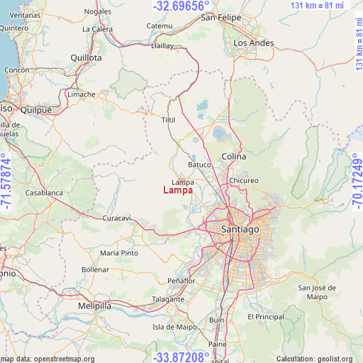
Lampa GPS coordinates[2]
33° 17' 10.68" South, 70° 52' 32.196" West
| Map corner | latitude | longitude |
|---|---|---|
| Upper-left | -32.69656°, | -71.57874° |
| Center: | -33.2863°, | -70.87561° |
| Lower-right: | -33.87208°, | -70.17249° |
| Map W x H: | 130.7×130.7 km | = 81.2×81.2mi |
| max Lat: | -18.19821° ⇑24.8% North |
| Lampa: | -33.2863° |
| min Lat: | ⇓75.2% South -54.93355° |
| min Long | Lampa | max Long |
| -109.42438° | -70.87561° | -67.60963° |
| W 75.2%⇐ | ⇒24.8% E |
Elevation
Elevation of Lampa is 498 m = 1634 ft, and this is 225 m = 738 ft above average elevation for this country.
| Max E: |
3544 m = 11627 ft | 15.2% |
| Lampa | 498 m 1634 ft | |
| Avg. | 273 m = 896 ft | |
Min E: |
1 m = 3 ft | 84.8% |
See also: Chile elevation on elevation.city.
Geographical zone
Lampa is located in South temperate zone (between Tropic of Capricorn and the Antarctic Circle). Distance of this Southern Tropic circle is 1095.2 km =680.5 mi to North.| Distance of | km | miles | from Lampa |
|---|---|---|---|
| Equator | 3701.1 | 2299.8 | to North |
| Tropic Capricorn | 1095.2 | 680.5 | to North |
| Antarctic Circle | 3700.1 | 2299.1 | to South |
| South Pole | 6306 | 3918.4 | to South |


Nearby cities:
15 places around Lampa: (largest is in red/bold)
• Buin
51.1 km =31.8 mi,  166°
166°
• Chicureo Abajo
20.7 km =12.9 mi,  89°
89°
• Colina
20.8 km =12.9 mi,  64°
64°
• El Monte
44.9 km =27.9 mi,  193°
193°
• La Pintana
39.9 km =24.8 mi,  145°
145°
• Limache
47.2 km =29.3 mi,  309°
309°
• Llaillay
50.1 km =31.1 mi,  351°
351°
• Lo Prado
22.4 km =13.9 mi,  141°
141°
• Peñaflor
35.6 km =22.1 mi,  180°
180°
• Providencia
29.9 km =18.6 mi,  122°
122°
• Puente Alto
45.6 km =28.3 mi, 142°
• San Bernardo
37.7 km =23.4 mi, 154°
• Santiago
28.4 km =17.6 mi,  131°
131°
• Talagante
42.3 km =26.3 mi, 186°
• Villa Presidente Frei, Ñuñoa, Santiago, Chile
33.6 km =20.9 mi, 125°
Sources, notices
• [Note1] Compared only with cities in Chile existing in our database
• [Src1] Map data: © OpenStreetMap contributors (CC-BY-SA)
• [Src2] Other city data from geonames.org with taken over terms of usage.
• [Src3] Geographical zone / Annual Mean Temperature by Robert A. Rohde @ Wikipedia
