Llaillay geodata
Llaillay (Valparaíso) is a populated place; located in Chile in America/Santiago (GMT-4) time zone. With population of 16,646 people, there are 90 cities with bigger population in this country. Compared to other cities in Chile, 81.4% of cities are located further ↓South; 72.4% of cities are located further ←West and 80% of cities have lower elevation than Llaillay. Note1
Administrative division(s):
- Level 1: Valparaíso
- Level 2: Provincia de San Felipe de Aconcagua
- Level 3: Llaillay


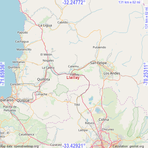
Llaillay GPS coordinates[2]
32° 50' 25.548" South, 70° 57' 22.428" West
| Map corner | latitude | longitude |
|---|---|---|
| Upper-left | -32.24772°, | -71.65936° |
| Center: | -32.84043°, | -70.95623° |
| Lower-right: | -33.42921°, | -70.25311° |
| Map W x H: | 131.4×131.4 km | = 81.6×81.6mi |
| max Lat: | -18.19821° ⇑18.6% North |
| Llaillay: | -32.84043° |
| min Lat: | ⇓81.4% South -54.93355° |
| min Long | Llaillay | max Long |
| -109.42438° | -70.95623° | -67.60963° |
| W 72.4%⇐ | ⇒27.6% E |
Elevation
Elevation of Llaillay is 395 m = 1296 ft, and this is 122 m = 400 ft above average elevation for this country.
| Max E: |
3544 m = 11627 ft | 20% |
| Llaillay | 395 m 1296 ft | |
| Avg. | 273 m = 896 ft | |
Min E: |
1 m = 3 ft | 80% |
See also: Chile elevation on elevation.city.
Geographical zone
Llaillay is located in South temperate zone (between Tropic of Capricorn and the Antarctic Circle). Distance of this Southern Tropic circle is 1045.6 km =649.7 mi to North.| Distance of | km | miles | from Llaillay |
|---|---|---|---|
| Equator | 3651.5 | 2268.9 | to North |
| Tropic Capricorn | 1045.6 | 649.7 | to North |
| Antarctic Circle | 3749.7 | 2330 | to South |
| South Pole | 6355.5 | 3949.1 | to South |


Nearby cities:
15 places around Llaillay: (largest is in red/bold)
• Chicureo Abajo
56.8 km =35.3 mi,  150°
150°
• Colina
48.2 km =30 mi, 147°
• Hacienda La Calera
25.2 km =15.7 mi,  284°
284°
• La Ligua
50.2 km =31.2 mi,  329°
329°
• Lampa
50.1 km =31.1 mi,  171°
171°
• Limache
35 km =21.7 mi,  235°
235°
• Lo Prado
70.5 km =43.8 mi,  162°
162°
• Los Andes
33.5 km =20.8 mi,  88°
88°
• Providencia
73.4 km =45.6 mi, 153°
• Quillota
27.7 km =17.2 mi,  260°
260°
• Quilpué
50.9 km =31.6 mi, 243°
• San Felipe
23.8 km =14.8 mi,  64°
64°
• Valparaíso
66.5 km =41.3 mi,  250°
250°
• Villa Alemana
44.9 km =27.9 mi, 240°
• Viña del Mar
59.2 km =36.8 mi, 249°
Sources, notices
• [Note1] Compared only with cities in Chile existing in our database
• [Src1] Map data: © OpenStreetMap contributors (CC-BY-SA)
• [Src2] Other city data from geonames.org with taken over terms of usage.
• [Src3] Geographical zone / Annual Mean Temperature by Robert A. Rohde @ Wikipedia
