Buin geodata
Buin (Santiago Metropolitan) is a populated place; located in Chile in America/Santiago (GMT-4) time zone. With population of 55,441 people, there are 38 cities with bigger population in this country. Compared to other cities in Chile, 64.8% of cities are located further ↓South; 77.9% of cities are located further ←West and 83.4% of cities have lower elevation than Buin. Note1
Administrative division(s):
- Level 1: Santiago Metropolitan
- Level 2: Provincia de Maipo
- Level 3: Buin


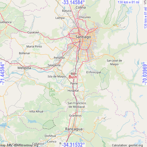
Buin GPS coordinates[2]
33° 43' 57.252" South, 70° 44' 34.116" West
| Map corner | latitude | longitude |
|---|---|---|
| Upper-left | -33.14584°, | -71.44594° |
| Center: | -33.73257°, | -70.74281° |
| Lower-right: | -34.31532°, | -70.03969° |
| Map W x H: | 130×130 km | = 80.8×80.8mi |
| max Lat: | -18.19821° ⇑35.2% North |
| Buin: | -33.73257° |
| min Lat: | ⇓64.8% South -54.93355° |
| min Long | Buin | max Long |
| -109.42438° | -70.74281° | -67.60963° |
| W 77.9%⇐ | ⇒22.1% E |
Elevation
Elevation of Buin is 483 m = 1585 ft, and this is 210 m = 689 ft above average elevation for this country.
| Max E: |
3544 m = 11627 ft | 16.6% |
| Buin | 483 m 1585 ft | |
| Avg. | 273 m = 896 ft | |
Min E: |
1 m = 3 ft | 83.4% |
See also: Buin elevation on elevation.city.
Geographical zone
Buin is located in South temperate zone (between Tropic of Capricorn and the Antarctic Circle). Distance of this Southern Tropic circle is 1144.8 km =711.3 mi to North.| Distance of | km | miles | from Buin |
|---|---|---|---|
| Equator | 3750.7 | 2330.6 | to North |
| Tropic Capricorn | 1144.8 | 711.3 | to North |
| Antarctic Circle | 3650.5 | 2268.3 | to South |
| South Pole | 6256.4 | 3887.5 | to South |


Nearby cities:
15 places around Buin: (largest is in red/bold)
• Chicureo Abajo
50.6 km =31.4 mi,  9°
9°
• El Monte
23.1 km =14.4 mi,  284°
284°
• Graneros
37.4 km =23.2 mi,  177°
177°
• La Pintana
19.4 km =12.1 mi,  31°
31°
• Lo Prado
32.1 km =19.9 mi,  2°
2°
• Melipilla
44 km =27.3 mi, 276°
• Paine
8.4 km =5.2 mi, 178°
• Peñaflor
18.7 km =11.6 mi,  318°
318°
• Providencia
35.9 km =22.3 mi,  20°
20°
• Puente Alto
20.5 km =12.7 mi,  48°
48°
• Rancagua
48.7 km =30.3 mi, 180°
• San Bernardo
16.1 km =10 mi, 14°
• Santiago
31.9 km =19.8 mi, 15°
• Talagante
18.7 km =11.6 mi,  294°
294°
• Villa Presidente Frei, Ñuñoa, Santiago, Chile
33.8 km =21 mi, 26°
Sources, notices
• [Note1] Compared only with cities in Chile existing in our database
• [Src1] Map data: © OpenStreetMap contributors (CC-BY-SA)
• [Src2] Other city data from geonames.org with taken over terms of usage.
• [Src3] Geographical zone / Annual Mean Temperature by Robert A. Rohde @ Wikipedia
