Cabrero geodata
Cabrero (Biobío) is a populated place; located in Chile in America/Santiago (GMT-4) time zone. With population of 18,327 people, there are 84 cities with bigger population in this country. Compared to other cities in Chile, 58.6% of cities are located further ↑North; 62.8% of cities are located further →East and 51.7% of cities have higher elevation than Cabrero. Note1


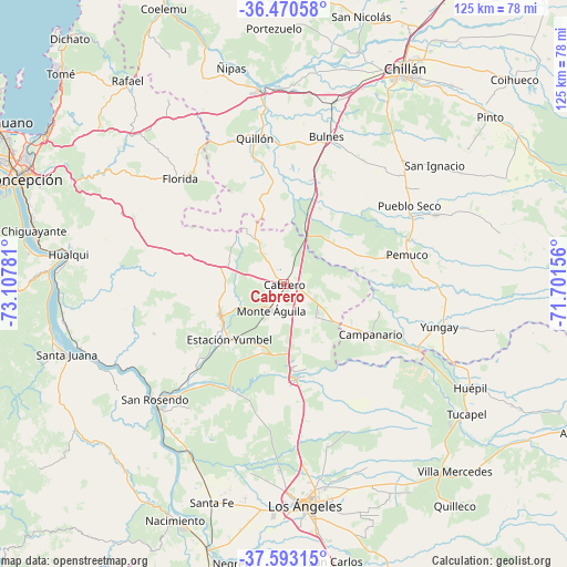
Cabrero GPS coordinates[2]
37° 2' 2.184" South, 72° 24' 16.848" West
| Map corner | latitude | longitude |
|---|---|---|
| Upper-left | -36.47058°, | -73.10781° |
| Center: | -37.03394°, | -72.40468° |
| Lower-right: | -37.59315°, | -71.70156° |
| Map W x H: | 124.8×124.8 km | = 77.5×77.5mi |
| max Lat: | -18.19821° ⇑58.6% North |
| Cabrero: | -37.03394° |
| min Lat: | ⇓41.4% South -54.93355° |
| min Long | Cabrero | max Long |
| -109.42438° | -72.40468° | -67.60963° |
| W 37.2%⇐ | ⇒62.8% E |
Elevation
Elevation of Cabrero is 129 m = 423 ft, and this is 144 m = 472 ft below average elevation for this country.
| Max E: |
3544 m = 11627 ft | 51.7% |
| Avg. | 273 m = 896 ft | |
| Cabrero | 129 m = 423 ft | |
Min E: |
1 m = 3 ft | 48.3% |
See also: Chile elevation on elevation.city.
Geographical zone
Cabrero is located in South temperate zone (between Tropic of Capricorn and the Antarctic Circle). Distance of this Southern Tropic circle is 1511.9 km =939.5 mi to North.| Distance of | km | miles | from Cabrero |
|---|---|---|---|
| Equator | 4117.8 | 2558.7 | to North |
| Tropic Capricorn | 1511.9 | 939.5 | to North |
| Antarctic Circle | 3283.4 | 2040.2 | to South |
| South Pole | 5889.3 | 3659.4 | to South |


Nearby cities:
15 places around Cabrero: (largest is in red/bold)
• Bulnes
33.8 km =21 mi,  16°
16°
• Chiguayante
56.7 km =35.2 mi,  282°
282°
• Chillán
54.6 km =33.9 mi,  29°
29°
• Coihueco
68.2 km =42.4 mi,  48°
48°
• Concepción
61.8 km =38.4 mi,  291°
291°
• Coronel
65.3 km =40.6 mi,  270°
270°
• Laja
38.9 km =24.2 mi,  224°
224°
• Los Ángeles
48.7 km =30.3 mi,  174°
174°
• Lota
67.1 km =41.7 mi,  264°
264°
• Mulchén
77.5 km =48.2 mi, 169°
• Nacimiento
57.3 km =35.6 mi,  204°
204°
• Penco
61.8 km =38.4 mi,  301°
301°
• Talcahuano
72.1 km =44.8 mi, 298°
• Tomé
67.5 km =41.9 mi,  313°
313°
• Yumbel
15.6 km =9.7 mi,  242°
242°
Sources, notices
• [Note1] Compared only with cities in Chile existing in our database
• [Src1] Map data: © OpenStreetMap contributors (CC-BY-SA)
• [Src2] Other city data from geonames.org with taken over terms of usage.
• [Src3] Geographical zone / Annual Mean Temperature by Robert A. Rohde @ Wikipedia
