Coihueco geodata
Coihueco (Ñuble) is a populated place; located in Chile in America/Santiago (GMT-4) time zone. With population of 7,346 people, there are 115 cities with bigger population in this country. Compared to other cities in Chile, 53.8% of cities are located further ↑North; 53.1% of cities are located further →East and 69% of cities have lower elevation than Coihueco. Note1


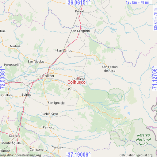
Coihueco GPS coordinates[2]
36° 37' 40.26" South, 71° 49' 50.448" West
| Map corner | latitude | longitude |
|---|---|---|
| Upper-left | -36.06151°, | -72.53381° |
| Center: | -36.62785°, | -71.83068° |
| Lower-right: | -37.19006°, | -71.12756° |
| Map W x H: | 125.5×125.5 km | = 78×78mi |
| max Lat: | -18.19821° ⇑53.8% North |
| Coihueco: | -36.62785° |
| min Lat: | ⇓46.2% South -54.93355° |
| min Long | Coihueco | max Long |
| -109.42438° | -71.83068° | -67.60963° |
| W 46.9%⇐ | ⇒53.1% E |
Elevation
Elevation of Coihueco is 257 m = 843 ft, and this is 16 m = 52 ft below average elevation for this country.
| Max E: |
3544 m = 11627 ft | 31% |
| Avg. | 273 m = 896 ft | |
| Coihueco | 257 m = 843 ft | |
Min E: |
1 m = 3 ft | 69% |
See also: Chile elevation on elevation.city.
Geographical zone
Coihueco is located in South temperate zone (between Tropic of Capricorn and the Antarctic Circle). Distance of this Southern Tropic circle is 1466.7 km =911.4 mi to North.| Distance of | km | miles | from Coihueco |
|---|---|---|---|
| Equator | 4072.6 | 2530.6 | to North |
| Tropic Capricorn | 1466.7 | 911.4 | to North |
| Antarctic Circle | 3328.5 | 2068.2 | to South |
| South Pole | 5934.4 | 3687.5 | to South |


Nearby cities:
15 places around Coihueco: (largest is in red/bold)
• Bulnes
43.6 km =27.1 mi,  253°
253°
• Cabrero
68.2 km =42.4 mi,  228°
228°
• Cauquenes
85.7 km =53.3 mi,  329°
329°
• Chillán
24.5 km =15.2 mi,  275°
275°
• Colbún
110.5 km =68.7 mi,  20°
20°
• Laja
107 km =66.5 mi, 226°
• Linares
89.4 km =55.6 mi,  13°
13°
• Longaví
74.9 km =46.5 mi, 10°
• Los Ángeles
104.5 km =64.9 mi,  206°
206°
• Parral
53.9 km =33.5 mi,  0°
0°
• Penco
104.6 km =65 mi,  263°
263°
• Quirihue
74.4 km =46.2 mi,  301°
301°
• San Carlos
25.3 km =15.7 mi, 333°
• Tomé
100.4 km =62.4 mi,  270°
270°
• Yumbel
83.4 km =51.8 mi, 231°
Sources, notices
• [Note1] Compared only with cities in Chile existing in our database
• [Src1] Map data: © OpenStreetMap contributors (CC-BY-SA)
• [Src2] Other city data from geonames.org with taken over terms of usage.
• [Src3] Geographical zone / Annual Mean Temperature by Robert A. Rohde @ Wikipedia
