Mme-Bafumen geodata
Mme-Bafumen (North-West) is a populated place; located in Cameroon in Africa/Douala (GMT+1) time zone. With population of 6,149 people, there are 92 cities with bigger population in this country. Compared to other cities in Cameroon, 77.9% of cities are located further ↓South; 71.3% of cities are located further →East and 91% of cities have lower elevation than Mme-Bafumen. Note1


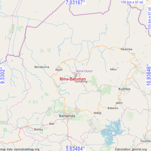
Mme-Bafumen GPS coordinates[2]
6° 19' 59.988" North, 10° 13' 59.988" East
| Map corner | latitude | longitude |
|---|---|---|
| Upper-left | 7.03167°, | 9.5302° |
| Center: | 6.33333°, | 10.23333° |
| Lower-right: | 5.63404°, | 10.93646° |
| Map W x H: | 155.4×155.4 km | = 96.6×96.6mi |
| max Lat: | 12.57535° ⇑22.1% North |
| Mme-Bafumen: | 6.33333° |
| min Lat: | ⇓77.9% South 2.35° |
| min Long | Mme-Bafumen | max Long |
| 8.8724° | 10.23333° | 15.23288° |
| W 28.7%⇐ | ⇒71.3% E |
Elevation
Elevation of Mme-Bafumen is 1403 m = 4603 ft, and this is 729.1 m = 2392 ft above average elevation for this country.
| Max E: |
1687 m = 5535 ft | 9% |
| Mme-Bafumen | 1403 m 4603 ft | |
| Avg. | 673.9 m = 2211 ft | |
Min E: |
1 m = 3 ft | 91% |
See also: Cameroon elevation on elevation.city.
Geographical zone
Mme-Bafumen is located in North Torrid zone (between Equator and Tropic of Cancer). Distance of Equator is 704.2 km =437.6 mi to South.| Distance of | km | miles | from Mme-Bafumen |
|---|---|---|---|
| North Pole | 9302.9 | 5780.6 | to North |
| Arctic Circle | 6697 | 4161.3 | to North |
| Tropic Cancer | 1901.7 | 1181.7 | to North |
| Equator | 704.2 | 437.6 | to South |


Nearby cities:
15 places around Mme-Bafumen: (largest is in red/bold)
• Babanki
24.2 km =15 mi,  175°
175°
• Bafoussam
97.3 km =60.5 mi,  167°
167°
• Bali
55.3 km =34.4 mi,  206°
206°
• Bamenda
42.7 km =26.5 mi,  193°
193°
• Bansoa
98.8 km =61.4 mi, 174°
• Batibo
69.3 km =43.1 mi,  217°
217°
• Belo
22.3 km =13.9 mi, 175°
• Foumban
99.8 km =62 mi,  132°
132°
• Fundong
10 km =6.2 mi,  158°
158°
• Jakiri
52.9 km =32.9 mi,  119°
119°
• Kumbo
50.1 km =31.1 mi,  107°
107°
• Mbengwi
43.6 km =27.1 mi, 216°
• Mbouda
78.7 km =48.9 mi, 178°
• Njinikom
12.4 km =7.7 mi,  153°
153°
• Wum
19.2 km =11.9 mi,  286°
286°
Sources, notices
• [Note1] Compared only with cities in Cameroon existing in our database
• [Src1] Map data: © OpenStreetMap contributors (CC-BY-SA)
• [Src2] Other city data from geonames.org with taken over terms of usage.
• [Src3] Geographical zone / Annual Mean Temperature by Robert A. Rohde @ Wikipedia
