Bafoussam geodata
Bafoussam (West) is a seat of a first-order administrative division; located in Cameroon in Africa/Douala (GMT+1) time zone. With population of 290,768 people, there are 6 cities with bigger population in this country. Compared to other cities in Cameroon, 62.3% of cities are located further ↓South; 62.3% of cities are located further →East and 93.4% of cities have lower elevation than Bafoussam. Note1


Bafoussam GPS coordinates[2]
5° 28' 39.9" North, 10° 25' 3.324" East
| Map corner | latitude | longitude |
|---|---|---|
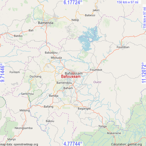
| Upper-left | 6.17724°, | 9.71446° |
| Center: | 5.47775°, | 10.41759° |
| Lower-right: | 4.77744°, | 11.12072° |
| Map W x H: | 155.6×155.6 km | = 96.7×96.7mi |
| max Lat: | 12.57535° ⇑37.7% North |
| Bafoussam: | 5.47775° |
| min Lat: | ⇓62.3% South 2.35° |
| min Long | Bafoussam | max Long |
| 8.8724° | 10.41759° | 15.23288° |
| W 37.7%⇐ | ⇒62.3% E |
Elevation
Elevation of Bafoussam is 1438 m = 4718 ft, and this is 764.1 m = 2507 ft above average elevation for this country.
| Max E: |
1687 m = 5535 ft | 6.6% |
| Bafoussam | 1438 m 4718 ft | |
| Avg. | 673.9 m = 2211 ft | |
Min E: |
1 m = 3 ft | 93.4% |
See also: Bafoussam elevation on elevation.city.
Geographical zone
Bafoussam is located in North Torrid zone (between Equator and Tropic of Cancer). Distance of Equator is 609.1 km =378.5 mi to South.| Distance of | km | miles | from Bafoussam |
|---|---|---|---|
| North Pole | 9398 | 5839.6 | to North |
| Arctic Circle | 6792.1 | 4220.4 | to North |
| Tropic Cancer | 1996.9 | 1240.8 | to North |
| Equator | 609.1 | 378.5 | to South |


Nearby cities:
15 places around Bafoussam: (largest is in red/bold)
• Bafang
44.5 km =27.7 mi,  216°
216°
• Bali
64 km =39.8 mi,  315°
315°
• Bamenda
61.4 km =38.2 mi,  330°
330°
• Bamendjou
13.8 km =8.6 mi, 224°
• Bana
40 km =24.9 mi,  203°
203°
• Bandjoun
11.4 km =7.1 mi,  182°
182°
• Bangangté
39.3 km =24.4 mi,  162°
162°
• Bansoa
12 km =7.5 mi,  254°
254°
• Bazou
46.8 km =29.1 mi,  173°
173°
• Dschang
40.5 km =25.2 mi,  264°
264°
• Fontem
59.3 km =36.8 mi,  269°
269°
• Foumban
60 km =37.3 mi,  62°
62°
• Foumbot
24 km =14.9 mi,  81°
81°
• Mbouda
24.5 km =15.2 mi,  312°
312°
• Ngou
31.4 km =19.5 mi,  186°
186°
Sources, notices
• [Note1] Compared only with cities in Cameroon existing in our database
• [Src1] Map data: © OpenStreetMap contributors (CC-BY-SA)
• [Src2] Other city data from geonames.org with taken over terms of usage.
• [Src3] Geographical zone / Annual Mean Temperature by Robert A. Rohde @ Wikipedia
