Foumban geodata
Foumban (West) is a populated place; located in Cameroon in Africa/Douala (GMT+1) time zone. With population of 92,673 people, there are 16 cities with bigger population in this country. Compared to other cities in Cameroon, 66.4% of cities are located further ↓South; 51.6% of cities are located further →East and 82.8% of cities have lower elevation than Foumban. Note1


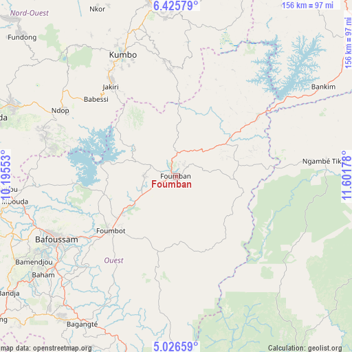
Foumban GPS coordinates[2]
5° 43' 35.832" North, 10° 53' 55.14" East
| Map corner | latitude | longitude |
|---|---|---|
| Upper-left | 6.42579°, | 10.19553° |
| Center: | 5.72662°, | 10.89865° |
| Lower-right: | 5.02659°, | 11.60178° |
| Map W x H: | 155.6×155.6 km | = 96.7×96.7mi |
| max Lat: | 12.57535° ⇑33.6% North |
| Foumban: | 5.72662° |
| min Lat: | ⇓66.4% South 2.35° |
| min Long | Foumban | max Long |
| 8.8724° | 10.89865° | 15.23288° |
| W 48.4%⇐ | ⇒51.6% E |
Elevation
Elevation of Foumban is 1179 m = 3868 ft, and this is 505.1 m = 1657 ft above average elevation for this country.
| Max E: |
1687 m = 5535 ft | 17.2% |
| Foumban | 1179 m 3868 ft | |
| Avg. | 673.9 m = 2211 ft | |
Min E: |
1 m = 3 ft | 82.8% |
See also: Foumban elevation on elevation.city.
Geographical zone
Foumban is located in North Torrid zone (between Equator and Tropic of Cancer). Distance of Equator is 636.7 km =395.6 mi to South.| Distance of | km | miles | from Foumban |
|---|---|---|---|
| North Pole | 9370.3 | 5822.4 | to North |
| Arctic Circle | 6764.4 | 4203.2 | to North |
| Tropic Cancer | 1969.2 | 1223.6 | to North |
| Equator | 636.7 | 395.6 | to South |


Nearby cities:
15 places around Foumban: (largest is in red/bold)
• Babanki
83.8 km =52.1 mi,  301°
301°
• Bafoussam
60 km =37.3 mi,  242°
242°
• Bamenda
87.2 km =54.2 mi,  287°
287°
• Bamendjou
73.2 km =45.5 mi, 239°
• Bandjoun
66.4 km =41.3 mi,  234°
234°
• Bangangté
77.1 km =47.9 mi,  212°
212°
• Bankim
76.5 km =47.5 mi,  58°
58°
• Bansoa
71.8 km =44.6 mi, 244°
• Belo
84.8 km =52.7 mi, 302°
• Foumbot
38.2 km =23.7 mi, 230°
• Jakiri
49.8 km =30.9 mi,  326°
326°
• Kumbo
58.6 km =36.4 mi, 334°
• Mbouda
72.2 km =44.9 mi,  261°
261°
• Ngou
81.8 km =50.8 mi,  223°
223°
• Tonga
87.3 km =54.2 mi,  194°
194°
Sources, notices
• [Note1] Compared only with cities in Cameroon existing in our database
• [Src1] Map data: © OpenStreetMap contributors (CC-BY-SA)
• [Src2] Other city data from geonames.org with taken over terms of usage.
• [Src3] Geographical zone / Annual Mean Temperature by Robert A. Rohde @ Wikipedia
