Zhuqi geodata
Zhuqi (Fujian) is a seat of a fourth-order administrative division; located in China in Asia/Shanghai (GMT+8) time zone. With population of 2,300 people, there are 1000 cities with bigger population in this country. Compared to other cities in China, 81.7% of cities are located further ↑North; 76.6% of cities are located further ←West and 78.8% of cities have higher elevation than Zhuqi. Note1


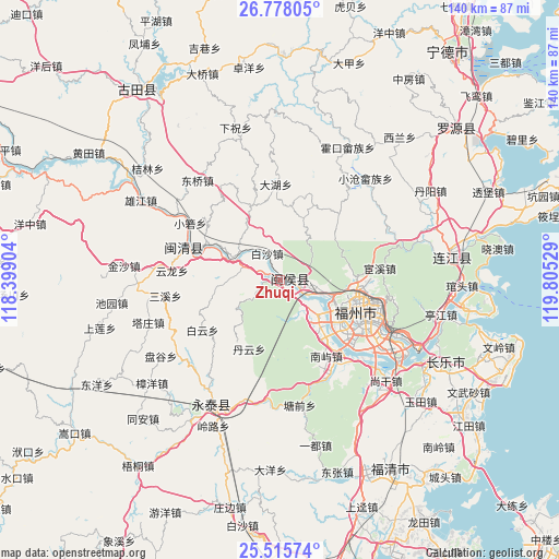
Zhuqi GPS coordinates[2]
26° 8' 54.96" North, 119° 6' 7.776" East
| Map corner | latitude | longitude |
|---|---|---|
| Upper-left | 26.77805°, | 118.39904° |
| Center: | 26.1486°, | 119.10216° |
| Lower-right: | 25.51574°, | 119.80529° |
| Map W x H: | 140.4×140.4 km | = 87.2×87.2mi |
| max Lat: | 53.31946° ⇑81.7% North |
| Zhuqi: | 26.1486° |
| min Lat: | ⇓18.3% South 18.22056° |
| min Long | Zhuqi | max Long |
| 75.07348° | 119.10216° | 134.28917° |
| W 76.6%⇐ | ⇒23.4% E |
Elevation
Elevation of Zhuqi is 29 m = 95 ft, and this is 455.8 m = 1495 ft below average elevation for this country.
| Max E: |
5622 m = 18445 ft | 78.8% |
| Avg. | 484.8 m = 1591 ft | |
| Zhuqi | 29 m = 95 ft | |
Min E: |
-3 m = -10 ft | 21.2% |
See also: China elevation on elevation.city.
Geographical zone
Zhuqi is located in North temperate zone (between Tropic of Cancer and the Arctic Circle). Distance of this Northern Tropic circle is 301.5 km =187.3 mi to South.| Distance of | km | miles | from Zhuqi |
|---|---|---|---|
| North Pole | 7099.6 | 4411.5 | to North |
| Arctic Circle | 4493.7 | 2792.3 | to North |
| Tropic Cancer | 301.5 | 187.3 | to South |
| Equator | 2907.5 | 1806.6 | to South |


Nearby cities:
15 places around Zhuqi: (largest is in red/bold)
• Baisha
7.5 km =4.7 mi,  333°
333°
• Danyun
19 km =11.8 mi,  205°
205°
• Guxi
19.3 km =12 mi,  109°
109°
• Hongshan
18.5 km =11.5 mi, 114°
• Hongtang
15.5 km =9.6 mi,  124°
124°
• Hongwei
10.8 km =6.7 mi,  282°
282°
• Huada
19.2 km =11.9 mi, 106°
• Huai’an
13.1 km =8.1 mi, 114°
• Jianxin
15.4 km =9.6 mi, 124°
• Jingxi
7.7 km =4.8 mi, 106°
• Lingtou
17.6 km =10.9 mi,  75°
75°
• Rong’an
3.3 km =2.1 mi,  144°
144°
• Shangjie
10.7 km =6.6 mi,  129°
129°
• Shoushan
17.1 km =10.6 mi,  51°
51°
• Wufeng
18.2 km =11.3 mi, 105°
Sources, notices
• [Note1] Compared only with cities in China existing in our database
• [Src1] Map data: © OpenStreetMap contributors (CC-BY-SA)
• [Src2] Other city data from geonames.org with taken over terms of usage.
• [Src3] Geographical zone / Annual Mean Temperature by Robert A. Rohde @ Wikipedia
