Zhukou geodata
Zhukou (Fujian) is a seat of a fourth-order administrative division; located in China in Asia/Shanghai (GMT+8) time zone. In our database, there are 1268 cities with bigger population. Compared to other cities in China, 78.7% of cities are located further ↑North; 67.6% of cities are located further ←West and 64.3% of cities have lower elevation than Zhukou. Note1


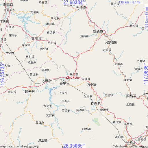
Zhukou GPS coordinates[2]
26° 58' 44.364" North, 117° 15' 37.692" East
| Map corner | latitude | longitude |
|---|---|---|
| Upper-left | 27.60384°, | 116.55735° |
| Center: | 26.97899°, | 117.26047° |
| Lower-right: | 26.35065°, | 117.9636° |
| Map W x H: | 139.3×139.3 km | = 86.6×86.6mi |
| max Lat: | 53.31946° ⇑78.7% North |
| Zhukou: | 26.97899° |
| min Lat: | ⇓21.3% South 18.22056° |
| min Long | Zhukou | max Long |
| 75.07348° | 117.26047° | 134.28917° |
| W 67.6%⇐ | ⇒32.4% E |
Elevation
Elevation of Zhukou is 315 m = 1033 ft, and this is 169.8 m = 557 ft below average elevation for this country.
| Max E: |
5622 m = 18445 ft | 35.7% |
| Avg. | 484.8 m = 1591 ft | |
| Zhukou | 315 m = 1033 ft | |
Min E: |
-3 m = -10 ft | 64.3% |
See also: China elevation on elevation.city.
Geographical zone
Zhukou is located in North temperate zone (between Tropic of Cancer and the Arctic Circle). Distance of this Northern Tropic circle is 393.9 km =244.8 mi to South.| Distance of | km | miles | from Zhukou |
|---|---|---|---|
| North Pole | 7007.3 | 4354.1 | to North |
| Arctic Circle | 4401.4 | 2734.9 | to North |
| Tropic Cancer | 393.9 | 244.8 | to South |
| Equator | 2999.8 | 1864 | to South |


Nearby cities:
15 places around Zhukou: (largest is in red/bold)
• Anren
17 km =10.6 mi,  93°
93°
• Dabu
38.6 km =24 mi,  220°
220°
• Datian
26.4 km =16.4 mi,  257°
257°
• Dayuan
12 km =7.5 mi,  111°
111°
• Gaotang
37.8 km =23.5 mi,  121°
121°
• Guangming
24.2 km =15 mi,  147°
147°
• Guyong
34.4 km =21.4 mi,  143°
143°
• Huangfang
37.8 km =23.5 mi,  270°
270°
• Huangtan
34.1 km =21.2 mi,  169°
169°
• Kaishan
26.3 km =16.3 mi,  197°
197°
• Shancheng
13 km =8.1 mi,  227°
227°
• Wanquan
35 km =21.7 mi,  192°
192°
• Wan’an
18.7 km =11.6 mi, 119°
• Xiaqu
20.1 km =12.5 mi,  210°
210°
• Yufang
8.6 km =5.3 mi,  183°
183°
Sources, notices
• [Note1] Compared only with cities in China existing in our database
• [Src1] Map data: © OpenStreetMap contributors (CC-BY-SA)
• [Src2] Other city data from geonames.org with taken over terms of usage.
• [Src3] Geographical zone / Annual Mean Temperature by Robert A. Rohde @ Wikipedia
