Guyong geodata
Guyong (Fujian) is a seat of a third-order administrative division; located in China in Asia/Shanghai (GMT+8) time zone. In our database, there are 1268 cities with bigger population. Compared to other cities in China, 79.6% of cities are located further ↑North; 68.6% of cities are located further ←West and 50.3% of cities have higher elevation than Guyong. Note1


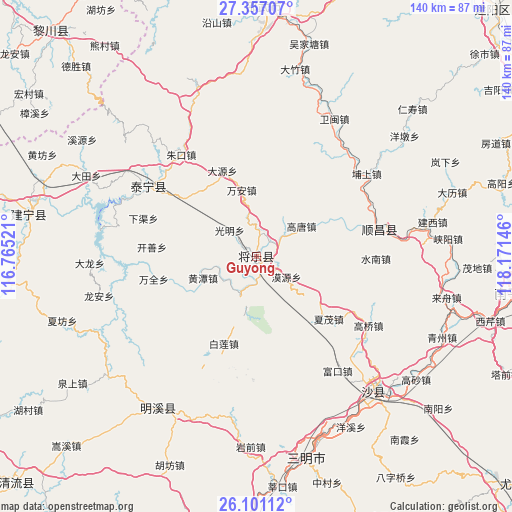
Guyong GPS coordinates[2]
26° 43' 50.988" North, 117° 28' 5.988" East
| Map corner | latitude | longitude |
|---|---|---|
| Upper-left | 27.35707°, | 116.76521° |
| Center: | 26.73083°, | 117.46833° |
| Lower-right: | 26.10112°, | 118.17146° |
| Map W x H: | 139.6×139.6 km | = 86.7×86.7mi |
| max Lat: | 53.31946° ⇑79.6% North |
| Guyong: | 26.73083° |
| min Lat: | ⇓20.4% South 18.22056° |
| min Long | Guyong | max Long |
| 75.07348° | 117.46833° | 134.28917° |
| W 68.6%⇐ | ⇒31.4% E |
Elevation
Elevation of Guyong is 162 m = 531 ft, and this is 322.8 m = 1059 ft below average elevation for this country.
| Max E: |
5622 m = 18445 ft | 50.3% |
| Avg. | 484.8 m = 1591 ft | |
| Guyong | 162 m = 531 ft | |
Min E: |
-3 m = -10 ft | 49.7% |
See also: China elevation on elevation.city.
Geographical zone
Guyong is located in North temperate zone (between Tropic of Cancer and the Arctic Circle). Distance of this Northern Tropic circle is 366.3 km =227.6 mi to South.| Distance of | km | miles | from Guyong |
|---|---|---|---|
| North Pole | 7034.9 | 4371.3 | to North |
| Arctic Circle | 4429 | 2752.1 | to North |
| Tropic Cancer | 366.3 | 227.6 | to South |
| Equator | 2972.2 | 1846.8 | to South |


Nearby cities:
15 places around Guyong: (largest is in red/bold)
• Anren
26.8 km =16.7 mi,  352°
352°
• Bailian
25.5 km =15.8 mi,  200°
200°
• Dayuan
25.1 km =15.6 mi,  338°
338°
• Gaotang
14.3 km =8.9 mi,  55°
55°
• Guangming
10.5 km =6.5 mi,  312°
312°
• Huangtan
15.9 km =9.9 mi,  247°
247°
• Kaishan
28.7 km =17.8 mi,  274°
274°
• Moyuan
10 km =6.2 mi,  125°
125°
• Nankou
12.7 km =7.9 mi, 203°
• Wanquan
28.9 km =18 mi,  256°
256°
• Wan’an
18.9 km =11.7 mi, 346°
• Xiamao
26.1 km =16.2 mi, 131°
• Yuankeng
24.3 km =15.1 mi,  81°
81°
• Yufang
28.5 km =17.7 mi, 311°
• Zhengfang
23.8 km =14.8 mi,  94°
94°
Sources, notices
• [Note1] Compared only with cities in China existing in our database
• [Src1] Map data: © OpenStreetMap contributors (CC-BY-SA)
• [Src2] Other city data from geonames.org with taken over terms of usage.
• [Src3] Geographical zone / Annual Mean Temperature by Robert A. Rohde @ Wikipedia
