Zhongfang geodata
Zhongfang (Fujian) is a populated place; located in China in Asia/Shanghai (GMT+8) time zone. With population of 1,180 people, there are 1139 cities with bigger population in this country. Compared to other cities in China, 80.1% of cities are located further ↑North; 78.3% of cities are located further ←West and 74.3% of cities have lower elevation than Zhongfang. Note1


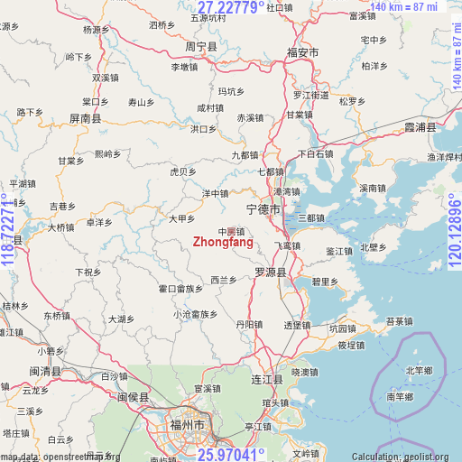
Zhongfang GPS coordinates[2]
26° 36' 2.988" North, 119° 25' 32.988" East
| Map corner | latitude | longitude |
|---|---|---|
| Upper-left | 27.22779°, | 118.72271° |
| Center: | 26.60083°, | 119.42583° |
| Lower-right: | 25.97041°, | 120.12896° |
| Map W x H: | 139.8×139.8 km | = 86.9×86.9mi |
| max Lat: | 53.31946° ⇑80.1% North |
| Zhongfang: | 26.60083° |
| min Lat: | ⇓19.9% South 18.22056° |
| min Long | Zhongfang | max Long |
| 75.07348° | 119.42583° | 134.28917° |
| W 78.3%⇐ | ⇒21.7% E |
Elevation
Elevation of Zhongfang is 507 m = 1663 ft, and this is 22.2 m = 73 ft above average elevation for this country.
| Max E: |
5622 m = 18445 ft | 25.7% |
| Zhongfang | 507 m 1663 ft | |
| Avg. | 484.8 m = 1591 ft | |
Min E: |
-3 m = -10 ft | 74.3% |
See also: China elevation on elevation.city.
Geographical zone
Zhongfang is located in North temperate zone (between Tropic of Cancer and the Arctic Circle). Distance of this Northern Tropic circle is 351.8 km =218.6 mi to South.| Distance of | km | miles | from Zhongfang |
|---|---|---|---|
| North Pole | 7049.3 | 4380.2 | to North |
| Arctic Circle | 4443.4 | 2761 | to North |
| Tropic Cancer | 351.8 | 218.6 | to South |
| Equator | 2957.7 | 1837.8 | to South |


Nearby cities:
15 places around Zhongfang: (largest is in red/bold)
• Dajia
15.5 km =9.6 mi,  285°
285°
• Feiluan
17.6 km =10.9 mi,  104°
104°
• Feizhu
17.9 km =11.1 mi,  208°
208°
• Fengshan
17.7 km =11 mi,  136°
136°
• Hongyang
8.8 km =5.5 mi,  155°
155°
• Huokou
22.7 km =14.1 mi,  222°
222°
• Jitoucun
22.5 km =14 mi,  127°
127°
• Ningde
11.8 km =7.3 mi,  54°
54°
• Qibu
15.8 km =9.8 mi, 131°
• Qidu
21.9 km =13.6 mi,  33°
33°
• Shanyang
23.3 km =14.5 mi, 289°
• Songqi
24.5 km =15.2 mi,  80°
80°
• Xilan
15.5 km =9.6 mi,  194°
194°
• Yangzhong
12.7 km =7.9 mi,  336°
336°
• Zhangwan
20.6 km =12.8 mi, 53°
Sources, notices
• [Note1] Compared only with cities in China existing in our database
• [Src1] Map data: © OpenStreetMap contributors (CC-BY-SA)
• [Src2] Other city data from geonames.org with taken over terms of usage.
• [Src3] Geographical zone / Annual Mean Temperature by Robert A. Rohde @ Wikipedia
