Hongyang geodata
Hongyang (Fujian) is a populated place; located in China in Asia/Shanghai (GMT+8) time zone. With population of 1,850 people, there are 1050 cities with bigger population in this country. Compared to other cities in China, 80.4% of cities are located further ↑North; 78.6% of cities are located further ←West and 68.2% of cities have higher elevation than Hongyang. Note1


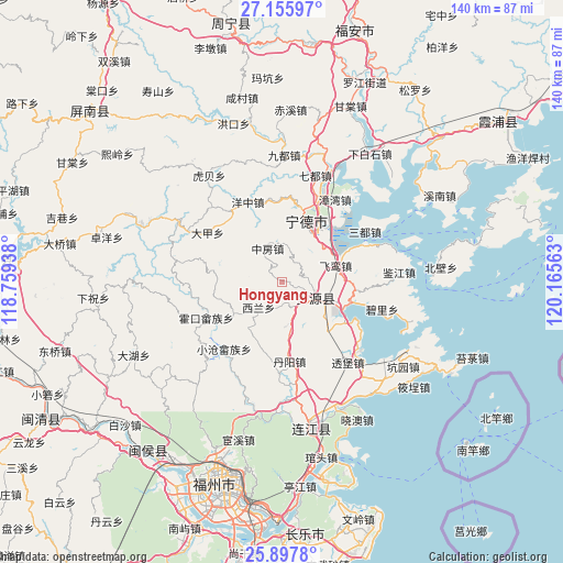
Hongyang GPS coordinates[2]
26° 31' 42.996" North, 119° 27' 45" East
| Map corner | latitude | longitude |
|---|---|---|
| Upper-left | 27.15597°, | 118.75938° |
| Center: | 26.52861°, | 119.4625° |
| Lower-right: | 25.8978°, | 120.16563° |
| Map W x H: | 139.9×139.9 km | = 86.9×86.9mi |
| max Lat: | 53.31946° ⇑80.4% North |
| Hongyang: | 26.52861° |
| min Lat: | ⇓19.6% South 18.22056° |
| min Long | Hongyang | max Long |
| 75.07348° | 119.4625° | 134.28917° |
| W 78.6%⇐ | ⇒21.4% E |
Elevation
Elevation of Hongyang is 59 m = 194 ft, and this is 425.8 m = 1397 ft below average elevation for this country.
| Max E: |
5622 m = 18445 ft | 68.2% |
| Avg. | 484.8 m = 1591 ft | |
| Hongyang | 59 m = 194 ft | |
Min E: |
-3 m = -10 ft | 31.8% |
See also: China elevation on elevation.city.
Geographical zone
Hongyang is located in North temperate zone (between Tropic of Cancer and the Arctic Circle). Distance of this Northern Tropic circle is 343.8 km =213.6 mi to South.| Distance of | km | miles | from Hongyang |
|---|---|---|---|
| North Pole | 7057.4 | 4385.3 | to North |
| Arctic Circle | 4451.5 | 2766 | to North |
| Tropic Cancer | 343.8 | 213.6 | to South |
| Equator | 2949.7 | 1832.9 | to South |


Nearby cities:
15 places around Hongyang: (largest is in red/bold)
• Beishancun
19.8 km =12.3 mi,  120°
120°
• Dajia
22.3 km =13.9 mi,  303°
303°
• Danyang
19.8 km =12.3 mi,  174°
174°
• Feiluan
13.9 km =8.6 mi,  74°
74°
• Feizhu
14.4 km =8.9 mi,  237°
237°
• Fengshan
9.9 km =6.2 mi, 119°
• Huokou
20.9 km =13 mi, 244°
• Jitoucun
15.3 km =9.5 mi,  112°
112°
• Liaoyan
18.1 km =11.2 mi,  192°
192°
• Ningde
16 km =9.9 mi,  22°
22°
• Qibu
8.5 km =5.3 mi, 105°
• Songqi
23.9 km =14.9 mi,  59°
59°
• Xilan
10.2 km =6.3 mi,  227°
227°
• Yangzhong
21.5 km =13.4 mi,  336°
336°
• Zhongfang
8.8 km =5.5 mi, 335°
Sources, notices
• [Note1] Compared only with cities in China existing in our database
• [Src1] Map data: © OpenStreetMap contributors (CC-BY-SA)
• [Src2] Other city data from geonames.org with taken over terms of usage.
• [Src3] Geographical zone / Annual Mean Temperature by Robert A. Rohde @ Wikipedia
