Yangzhong geodata
Yangzhong (Fujian) is a populated place; located in China in Asia/Shanghai (GMT+8) time zone. With population of 3,640 people, there are 914 cities with bigger population in this country. Compared to other cities in China, 79.7% of cities are located further ↑North; 78% of cities are located further ←West and 66.9% of cities have lower elevation than Yangzhong. Note1


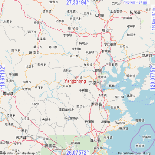
Yangzhong GPS coordinates[2]
26° 42' 20.016" North, 119° 22' 27.984" East
| Map corner | latitude | longitude |
|---|---|---|
| Upper-left | 27.33194°, | 118.67132° |
| Center: | 26.70556°, | 119.37444° |
| Lower-right: | 26.07572°, | 120.07757° |
| Map W x H: | 139.7×139.7 km | = 86.8×86.8mi |
| max Lat: | 53.31946° ⇑79.7% North |
| Yangzhong: | 26.70556° |
| min Lat: | ⇓20.3% South 18.22056° |
| min Long | Yangzhong | max Long |
| 75.07348° | 119.37444° | 134.28917° |
| W 78%⇐ | ⇒22% E |
Elevation
Elevation of Yangzhong is 358 m = 1175 ft, and this is 126.8 m = 416 ft below average elevation for this country.
| Max E: |
5622 m = 18445 ft | 33.1% |
| Avg. | 484.8 m = 1591 ft | |
| Yangzhong | 358 m = 1175 ft | |
Min E: |
-3 m = -10 ft | 66.9% |
See also: China elevation on elevation.city.
Geographical zone
Yangzhong is located in North temperate zone (between Tropic of Cancer and the Arctic Circle). Distance of this Northern Tropic circle is 363.5 km =225.9 mi to South.| Distance of | km | miles | from Yangzhong |
|---|---|---|---|
| North Pole | 7037.7 | 4373 | to North |
| Arctic Circle | 4431.8 | 2753.8 | to North |
| Tropic Cancer | 363.5 | 225.9 | to South |
| Equator | 2969.4 | 1845.1 | to South |


Nearby cities:
15 places around Yangzhong: (largest is in red/bold)
• Badu
22.1 km =13.7 mi,  58°
58°
• Chixi
25.3 km =15.7 mi,  25°
25°
• Dajia
12.3 km =7.6 mi,  233°
233°
• Feiluan
27.3 km =17 mi,  125°
125°
• Feizhu
27.6 km =17.1 mi,  187°
187°
• Hetang
26.6 km =16.5 mi,  259°
259°
• Hongyang
21.5 km =13.4 mi,  156°
156°
• Huotong
16.6 km =10.3 mi,  15°
15°
• Ningde
15.5 km =9.6 mi,  108°
108°
• Qidu
18.4 km =11.4 mi,  68°
68°
• Shanyang
17.3 km =10.7 mi, 256°
• Xiancun
26 km =16.2 mi,  356°
356°
• Xilan
26.7 km =16.6 mi,  177°
177°
• Zhangwan
21.6 km =13.4 mi,  88°
88°
• Zhongfang
12.7 km =7.9 mi, 156°
Sources, notices
• [Note1] Compared only with cities in China existing in our database
• [Src1] Map data: © OpenStreetMap contributors (CC-BY-SA)
• [Src2] Other city data from geonames.org with taken over terms of usage.
• [Src3] Geographical zone / Annual Mean Temperature by Robert A. Rohde @ Wikipedia
