Zhicheng geodata
Zhicheng (Zhejiang) is a populated place; located in China in Asia/Shanghai (GMT+8) time zone. With population of 63,753 people, there are 679 cities with bigger population in this country. Compared to other cities in China, 54.9% of cities are located further ↓South; 81.3% of cities are located further ←West and 87.7% of cities have higher elevation than Zhicheng. Note1


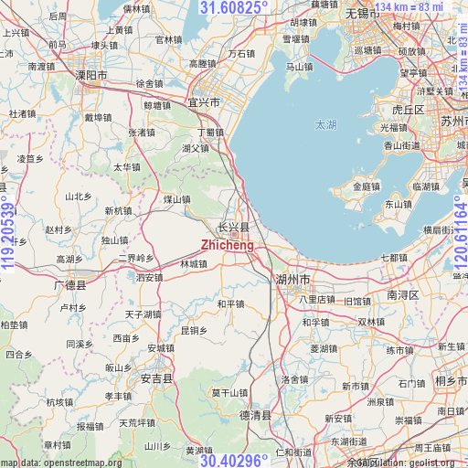
Zhicheng GPS coordinates[2]
31° 0' 27.036" North, 119° 54' 30.636" East
| Map corner | latitude | longitude |
|---|---|---|
| Upper-left | 31.60825°, | 119.20539° |
| Center: | 31.00751°, | 119.90851° |
| Lower-right: | 30.40296°, | 120.61164° |
| Map W x H: | 134×134 km | = 83.3×83.3mi |
| max Lat: | 53.31946° ⇑45.1% North |
| Zhicheng: | 31.00751° |
| min Lat: | ⇓54.9% South 18.22056° |
| min Long | Zhicheng | max Long |
| 75.07348° | 119.90851° | 134.28917° |
| W 81.3%⇐ | ⇒18.7% E |
Elevation
Elevation of Zhicheng is 12 m = 39 ft, and this is 472.8 m = 1551 ft below average elevation for this country.
| Max E: |
5622 m = 18445 ft | 87.7% |
| Avg. | 484.8 m = 1591 ft | |
| Zhicheng | 12 m = 39 ft | |
Min E: |
-3 m = -10 ft | 12.3% |
See also: Zhicheng elevation on elevation.city.
Geographical zone
Zhicheng is located in North temperate zone (between Tropic of Cancer and the Arctic Circle). Distance of this Northern Tropic circle is 841.8 km =523.1 mi to South.| Distance of | km | miles | from Zhicheng |
|---|---|---|---|
| North Pole | 6559.4 | 4075.8 | to North |
| Arctic Circle | 3953.5 | 2456.6 | to North |
| Tropic Cancer | 841.8 | 523.1 | to South |
| Equator | 3447.7 | 2142.3 | to South |


Nearby cities:
15 places around Zhicheng: (largest is in red/bold)
• Baique
20.5 km =12.7 mi,  118°
118°
• Heping
19.6 km =12.2 mi,  182°
182°
• Hongqiao
7.5 km =4.7 mi,  105°
105°
• Hongxingqiao
10.1 km =6.3 mi,  201°
201°
• Huaikan
22.8 km =14.2 mi,  287°
287°
• Huzhou
23.3 km =14.5 mi,  130°
130°
• Jiapu
11.2 km =7 mi,  14°
14°
• Lijiaxiang
9 km =5.6 mi, 134°
• Lincheng
14.2 km =8.8 mi,  234°
234°
• Lüshan
8.6 km =5.3 mi,  174°
174°
• Meishan
19.7 km =12.2 mi,  302°
302°
• Nangaoqiao
20.5 km =12.7 mi, 118°
• Sujiazhuang
21.5 km =13.4 mi, 134°
• Tianshengjie
24.2 km =15 mi, 126°
• Xiaopu
7.8 km =4.8 mi, 288°
Sources, notices
• [Note1] Compared only with cities in China existing in our database
• [Src1] Map data: © OpenStreetMap contributors (CC-BY-SA)
• [Src2] Other city data from geonames.org with taken over terms of usage.
• [Src3] Geographical zone / Annual Mean Temperature by Robert A. Rohde @ Wikipedia
