Xiaopu geodata
Xiaopu (Zhejiang) is a seat of a fourth-order administrative division; located in China in Asia/Shanghai (GMT+8) time zone. In our database, there are 1268 cities with bigger population. Compared to other cities in China, 55.1% of cities are located further ↓South; 80.8% of cities are located further ←West and 88.7% of cities have higher elevation than Xiaopu. Note1


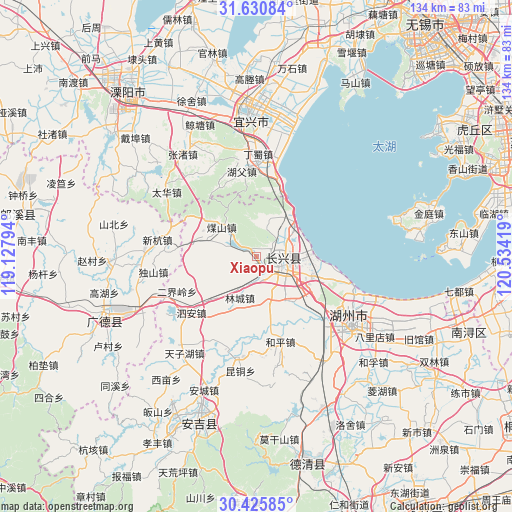
Xiaopu GPS coordinates[2]
31° 1' 48.9" North, 119° 49' 51.816" East
| Map corner | latitude | longitude |
|---|---|---|
| Upper-left | 31.63084°, | 119.12794° |
| Center: | 31.03025°, | 119.83106° |
| Lower-right: | 30.42585°, | 120.53419° |
| Map W x H: | 134×134 km | = 83.3×83.3mi |
| max Lat: | 53.31946° ⇑44.9% North |
| Xiaopu: | 31.03025° |
| min Lat: | ⇓55.1% South 18.22056° |
| min Long | Xiaopu | max Long |
| 75.07348° | 119.83106° | 134.28917° |
| W 80.8%⇐ | ⇒19.2% E |
Elevation
Elevation of Xiaopu is 11 m = 36 ft, and this is 473.8 m = 1554 ft below average elevation for this country.
| Max E: |
5622 m = 18445 ft | 88.7% |
| Avg. | 484.8 m = 1591 ft | |
| Xiaopu | 11 m = 36 ft | |
Min E: |
-3 m = -10 ft | 11.3% |
See also: China elevation on elevation.city.
Geographical zone
Xiaopu is located in North temperate zone (between Tropic of Cancer and the Arctic Circle). Distance of this Northern Tropic circle is 844.3 km =524.6 mi to South.| Distance of | km | miles | from Xiaopu |
|---|---|---|---|
| North Pole | 6556.8 | 4074.2 | to North |
| Arctic Circle | 3950.9 | 2455 | to North |
| Tropic Cancer | 844.3 | 524.6 | to South |
| Equator | 3450.2 | 2143.9 | to South |


Nearby cities:
15 places around Xiaopu: (largest is in red/bold)
• Baixian
16.9 km =10.5 mi,  304°
304°
• Dingshu
25.3 km =15.7 mi,  3°
3°
• Erjieling
22.6 km =14 mi,  246°
246°
• Heping
23.1 km =14.4 mi,  163°
163°
• Hongqiao
15.3 km =9.5 mi,  107°
107°
• Hongxingqiao
12.4 km =7.7 mi, 163°
• Huaikan
15 km =9.3 mi,  287°
287°
• Jiapu
13.2 km =8.2 mi,  51°
51°
• Lijiaxiang
16.4 km =10.2 mi,  122°
122°
• Lincheng
11.5 km =7.1 mi,  201°
201°
• Lüshan
13.9 km =8.6 mi,  143°
143°
• Meishan
12.2 km =7.6 mi,  311°
311°
• Si’an
22.4 km =13.9 mi,  229°
229°
• Xinhang
26.2 km =16.3 mi,  279°
279°
• Zhicheng
7.8 km =4.8 mi, 108°
Sources, notices
• [Note1] Compared only with cities in China existing in our database
• [Src1] Map data: © OpenStreetMap contributors (CC-BY-SA)
• [Src2] Other city data from geonames.org with taken over terms of usage.
• [Src3] Geographical zone / Annual Mean Temperature by Robert A. Rohde @ Wikipedia
