Yongxing geodata
Yongxing (Fujian) is a seat of a fourth-order administrative division; located in China in Asia/Shanghai (GMT+8) time zone. In our database, there are 1268 cities with bigger population. Compared to other cities in China, 74.4% of cities are located further ↑North; 72.4% of cities are located further ←West and 60% of cities have lower elevation than Yongxing. Note1


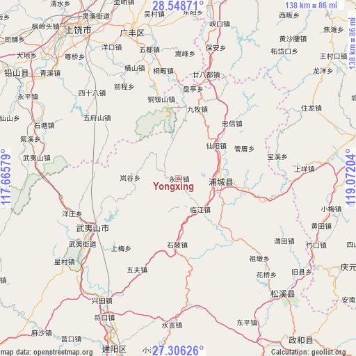
Yongxing GPS coordinates[2]
27° 55' 45.372" North, 118° 22' 8.076" East
| Map corner | latitude | longitude |
|---|---|---|
| Upper-left | 28.54871°, | 117.66579° |
| Center: | 27.92927°, | 118.36891° |
| Lower-right: | 27.30626°, | 119.07204° |
| Map W x H: | 138.1×138.1 km | = 85.8×85.8mi |
| max Lat: | 53.31946° ⇑74.4% North |
| Yongxing: | 27.92927° |
| min Lat: | ⇓25.6% South 18.22056° |
| min Long | Yongxing | max Long |
| 75.07348° | 118.36891° | 134.28917° |
| W 72.4%⇐ | ⇒27.6% E |
Elevation
Elevation of Yongxing is 259 m = 850 ft, and this is 225.8 m = 741 ft below average elevation for this country.
| Max E: |
5622 m = 18445 ft | 40% |
| Avg. | 484.8 m = 1591 ft | |
| Yongxing | 259 m = 850 ft | |
Min E: |
-3 m = -10 ft | 60% |
See also: China elevation on elevation.city.
Geographical zone
Yongxing is located in North temperate zone (between Tropic of Cancer and the Arctic Circle). Distance of this Northern Tropic circle is 499.5 km =310.4 mi to South.| Distance of | km | miles | from Yongxing |
|---|---|---|---|
| North Pole | 6901.6 | 4288.5 | to North |
| Arctic Circle | 4295.7 | 2669.2 | to North |
| Tropic Cancer | 499.5 | 310.4 | to South |
| Equator | 3105.4 | 1929.6 | to South |


Nearby cities:
15 places around Yongxing: (largest is in red/bold)
• Fuling
27 km =16.8 mi,  98°
98°
• Gaozhou
36.4 km =22.6 mi,  307°
307°
• Haocun
38.8 km =24.1 mi,  165°
165°
• Liantang
14.5 km =9 mi,  92°
92°
• Lingdi
31.6 km =19.6 mi,  347°
347°
• Linjiang
14.5 km =9 mi,  143°
143°
• Pucheng
16.2 km =10.1 mi, 92°
• Shanxia
16 km =9.9 mi,  204°
204°
• Shibei
25.8 km =16 mi,  181°
181°
• Shuibeijie
32.7 km =20.3 mi, 142°
• Wan’an
18.2 km =11.3 mi, 94°
• Wufu
38.7 km =24 mi, 204°
• Wufushan
39.5 km =24.5 mi, 307°
• Wuyishan
38.2 km =23.7 mi,  240°
240°
• Xianyang
19.6 km =12.2 mi,  48°
48°
Sources, notices
• [Note1] Compared only with cities in China existing in our database
• [Src1] Map data: © OpenStreetMap contributors (CC-BY-SA)
• [Src2] Other city data from geonames.org with taken over terms of usage.
• [Src3] Geographical zone / Annual Mean Temperature by Robert A. Rohde @ Wikipedia
