Wuyishan geodata
Wuyishan (Fujian) is a seat of a third-order administrative division; located in China in Asia/Shanghai (GMT+8) time zone. With population of 23,041 people, there are 805 cities with bigger population in this country. Compared to other cities in China, 75.4% of cities are located further ↑North; 70.7% of cities are located further ←West and 56.8% of cities have lower elevation than Wuyishan. Note1


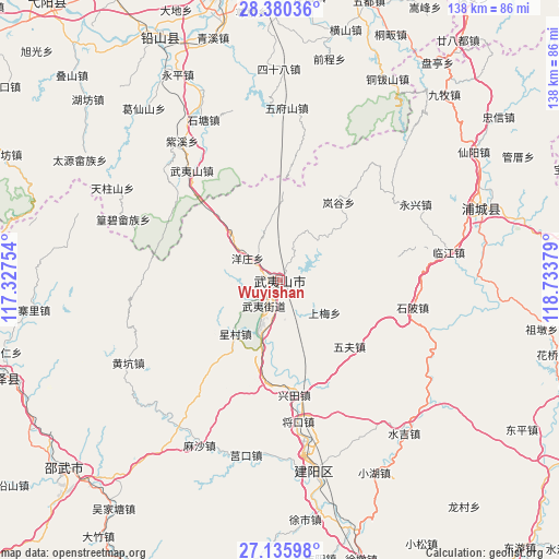
Wuyishan GPS coordinates[2]
27° 45' 35.82" North, 118° 1' 50.376" East
| Map corner | latitude | longitude |
|---|---|---|
| Upper-left | 28.38036°, | 117.32754° |
| Center: | 27.75995°, | 118.03066° |
| Lower-right: | 27.13598°, | 118.73379° |
| Map W x H: | 138.4×138.4 km | = 86×86mi |
| max Lat: | 53.31946° ⇑75.4% North |
| Wuyishan: | 27.75995° |
| min Lat: | ⇓24.6% South 18.22056° |
| min Long | Wuyishan | max Long |
| 75.07348° | 118.03066° | 134.28917° |
| W 70.7%⇐ | ⇒29.3% E |
Elevation
Elevation of Wuyishan is 224 m = 735 ft, and this is 260.8 m = 856 ft below average elevation for this country.
| Max E: |
5622 m = 18445 ft | 43.2% |
| Avg. | 484.8 m = 1591 ft | |
| Wuyishan | 224 m = 735 ft | |
Min E: |
-3 m = -10 ft | 56.8% |
See also: China elevation on elevation.city.
Geographical zone
Wuyishan is located in North temperate zone (between Tropic of Cancer and the Arctic Circle). Distance of this Northern Tropic circle is 480.7 km =298.7 mi to South.| Distance of | km | miles | from Wuyishan |
|---|---|---|---|
| North Pole | 6920.4 | 4300.1 | to North |
| Arctic Circle | 4314.6 | 2681 | to North |
| Tropic Cancer | 480.7 | 298.7 | to South |
| Equator | 3086.6 | 1917.9 | to South |


Nearby cities:
15 places around Wuyishan: (largest is in red/bold)
• Gaozhou
41.2 km =25.6 mi,  5°
5°
• Haocun
47 km =29.2 mi,  113°
113°
• Huanggangshan
39.8 km =24.7 mi,  314°
314°
• Huilong
48.4 km =30.1 mi,  129°
129°
• Linjiang
42.4 km =26.3 mi,  80°
80°
• Shanxia
27 km =16.8 mi, 80°
• Shibei
33.2 km =20.6 mi,  102°
102°
• Shitang
43.4 km =27 mi,  335°
335°
• Wufu
23.7 km =14.7 mi, 133°
• Wufushan
42.7 km =26.5 mi,  2°
2°
• Wuyishan
34.7 km =21.6 mi,  321°
321°
• Xingtian
29.1 km =18.1 mi,  173°
173°
• Yingjiang
43.7 km =27.2 mi, 344°
• Yongxing
38.2 km =23.7 mi,  60°
60°
• Zixi
42.1 km =26.2 mi, 324°
Sources, notices
• [Note1] Compared only with cities in China existing in our database
• [Src1] Map data: © OpenStreetMap contributors (CC-BY-SA)
• [Src2] Other city data from geonames.org with taken over terms of usage.
• [Src3] Geographical zone / Annual Mean Temperature by Robert A. Rohde @ Wikipedia
