Pucheng geodata
Pucheng (Fujian) is a seat of a third-order administrative division; located in China in Asia/Shanghai (GMT+8) time zone. With population of 59,832 people, there are 736 cities with bigger population in this country. Compared to other cities in China, 74.5% of cities are located further ↑North; 73.4% of cities are located further ←West and 57.9% of cities have lower elevation than Pucheng. Note1


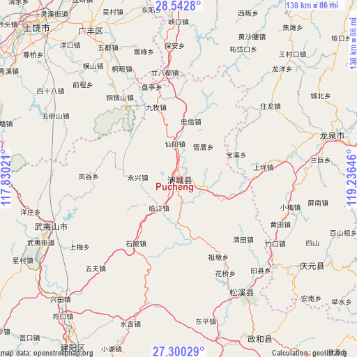
Pucheng GPS coordinates[2]
27° 55' 23.988" North, 118° 31' 59.988" East
| Map corner | latitude | longitude |
|---|---|---|
| Upper-left | 28.5428°, | 117.83021° |
| Center: | 27.92333°, | 118.53333° |
| Lower-right: | 27.30029°, | 119.23646° |
| Map W x H: | 138.2×138.2 km | = 85.9×85.9mi |
| max Lat: | 53.31946° ⇑74.5% North |
| Pucheng: | 27.92333° |
| min Lat: | ⇓25.5% South 18.22056° |
| min Long | Pucheng | max Long |
| 75.07348° | 118.53333° | 134.28917° |
| W 73.4%⇐ | ⇒26.6% E |
Elevation
Elevation of Pucheng is 235 m = 771 ft, and this is 249.8 m = 820 ft below average elevation for this country.
| Max E: |
5622 m = 18445 ft | 42.1% |
| Avg. | 484.8 m = 1591 ft | |
| Pucheng | 235 m = 771 ft | |
Min E: |
-3 m = -10 ft | 57.9% |
See also: Pucheng elevation on elevation.city.
Geographical zone
Pucheng is located in North temperate zone (between Tropic of Cancer and the Arctic Circle). Distance of this Northern Tropic circle is 498.9 km =310 mi to South.| Distance of | km | miles | from Pucheng |
|---|---|---|---|
| North Pole | 6902.3 | 4288.9 | to North |
| Arctic Circle | 4296.4 | 2669.7 | to North |
| Tropic Cancer | 498.9 | 310 | to South |
| Equator | 3104.8 | 1929.2 | to South |


Nearby cities:
15 places around Pucheng: (largest is in red/bold)
• Fuling
11.1 km =6.9 mi,  106°
106°
• Haocun
37.4 km =23.2 mi,  189°
189°
• Liantang
1.7 km =1.1 mi,  272°
272°
• Lingdi
39 km =24.2 mi,  323°
323°
• Linjiang
13.4 km =8.3 mi,  214°
214°
• Shangyang
33 km =20.5 mi,  81°
81°
• Shanxia
26.7 km =16.6 mi,  238°
238°
• Shibei
30.3 km =18.8 mi, 214°
• Shuibeijie
25.7 km =16 mi,  171°
171°
• Wan’an
2.2 km =1.4 mi, 110°
• Weitian
34.2 km =21.3 mi,  133°
133°
• Xianyang
13.7 km =8.5 mi,  353°
353°
• Xidong
30.9 km =19.2 mi, 128°
• Yongxing
16.2 km =10.1 mi, 272°
• Zudun
33.9 km =21.1 mi,  153°
153°
Sources, notices
• [Note1] Compared only with cities in China existing in our database
• [Src1] Map data: © OpenStreetMap contributors (CC-BY-SA)
• [Src2] Other city data from geonames.org with taken over terms of usage.
• [Src3] Geographical zone / Annual Mean Temperature by Robert A. Rohde @ Wikipedia
