Yingcui geodata
Yingcui (Sichuan) is a seat of a fourth-order administrative division; located in China in Asia/Shanghai (GMT+8) time zone. In our database, there are 1268 cities with bigger population. Compared to other cities in China, 63.9% of cities are located further ↓South; 85.3% of cities are located further →East and 78.3% of cities have lower elevation than Yingcui. Note1


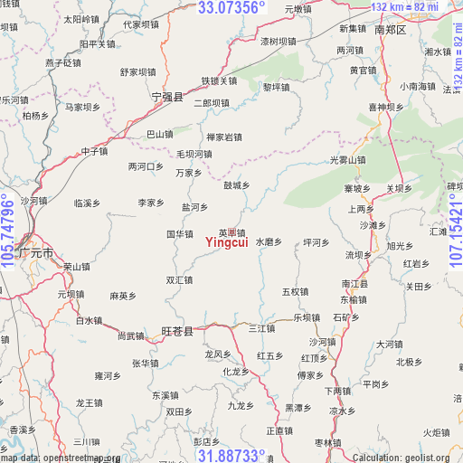
Yingcui GPS coordinates[2]
32° 28' 56.64" North, 106° 27' 3.888" East
| Map corner | latitude | longitude |
|---|---|---|
| Upper-left | 33.07356°, | 105.74796° |
| Center: | 32.4824°, | 106.45108° |
| Lower-right: | 31.88733°, | 107.15421° |
| Map W x H: | 131.9×131.9 km | = 82×82mi |
| max Lat: | 53.31946° ⇑36.1% North |
| Yingcui: | 32.4824° |
| min Lat: | ⇓63.9% South 18.22056° |
| min Long | Yingcui | max Long |
| 75.07348° | 106.45108° | 134.28917° |
| W 14.7%⇐ | ⇒85.3% E |
Elevation
Elevation of Yingcui is 625 m = 2051 ft, and this is 140.2 m = 460 ft above average elevation for this country.
| Max E: |
5622 m = 18445 ft | 21.7% |
| Yingcui | 625 m 2051 ft | |
| Avg. | 484.8 m = 1591 ft | |
Min E: |
-3 m = -10 ft | 78.3% |
See also: China elevation on elevation.city.
Geographical zone
Yingcui is located in North temperate zone (between Tropic of Cancer and the Arctic Circle). Distance of this Northern Tropic circle is 1005.8 km =625 mi to South.| Distance of | km | miles | from Yingcui |
|---|---|---|---|
| North Pole | 6395.4 | 3973.9 | to North |
| Arctic Circle | 3789.5 | 2354.7 | to North |
| Tropic Cancer | 1005.8 | 625 | to South |
| Equator | 3611.7 | 2244.2 | to South |


Nearby cities:
15 places around Yingcui: (largest is in red/bold)
• Donghe
31.1 km =19.3 mi,  206°
206°
• Guohua
14.9 km =9.3 mi,  268°
268°
• Huangyang
28.2 km =17.5 mi,  195°
195°
• Jinxi
29.1 km =18.1 mi,  138°
138°
• Leba
32.2 km =20 mi, 138°
• Lijia
24.6 km =15.3 mi,  290°
290°
• Longfeng
34.9 km =21.7 mi,  187°
187°
• Maying
35.8 km =22.2 mi,  239°
239°
• Puji
27.1 km =16.8 mi,  179°
179°
• Sanjiang
28.5 km =17.7 mi,  162°
162°
• Tuanjie
34.7 km =21.6 mi,  128°
128°
• Wangjia
28 km =17.4 mi,  279°
279°
• Wuquan
24.6 km =15.3 mi, 132°
• Yangba
31 km =19.3 mi,  91°
91°
• Yanhe
12.9 km =8 mi,  305°
305°
Sources, notices
• [Note1] Compared only with cities in China existing in our database
• [Src1] Map data: © OpenStreetMap contributors (CC-BY-SA)
• [Src2] Other city data from geonames.org with taken over terms of usage.
• [Src3] Geographical zone / Annual Mean Temperature by Robert A. Rohde @ Wikipedia
