Yetan geodata
Yetan (Guangdong) is a seat of a fourth-order administrative division; located in China in Asia/Shanghai (GMT+8) time zone. In our database, there are 1268 cities with bigger population. Compared to other cities in China, 90.7% of cities are located further ↑North; 55.3% of cities are located further ←West and 60.3% of cities have higher elevation than Yetan. Note1


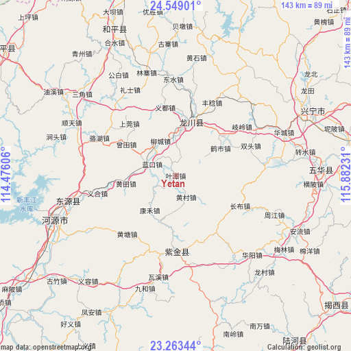
Yetan GPS coordinates[2]
23° 54' 28.152" North, 115° 10' 45.048" East
| Map corner | latitude | longitude |
|---|---|---|
| Upper-left | 24.54901°, | 114.47606° |
| Center: | 23.90782°, | 115.17918° |
| Lower-right: | 23.26344°, | 115.88231° |
| Map W x H: | 142.9×142.9 km | = 88.8×88.8mi |
| max Lat: | 53.31946° ⇑90.7% North |
| Yetan: | 23.90782° |
| min Lat: | ⇓9.3% South 18.22056° |
| min Long | Yetan | max Long |
| 75.07348° | 115.17918° | 134.28917° |
| W 55.3%⇐ | ⇒44.7% E |
Elevation
Elevation of Yetan is 97 m = 318 ft, and this is 387.8 m = 1272 ft below average elevation for this country.
| Max E: |
5622 m = 18445 ft | 60.3% |
| Avg. | 484.8 m = 1591 ft | |
| Yetan | 97 m = 318 ft | |
Min E: |
-3 m = -10 ft | 39.7% |
See also: China elevation on elevation.city.
Geographical zone
Yetan is located in North temperate zone (between Tropic of Cancer and the Arctic Circle). Distance of this Northern Tropic circle is 52.4 km =32.6 mi to South.| Distance of | km | miles | from Yetan |
|---|---|---|---|
| North Pole | 7348.8 | 4566.3 | to North |
| Arctic Circle | 4742.9 | 2947.1 | to North |
| Tropic Cancer | 52.4 | 32.6 | to South |
| Equator | 2658.3 | 1651.8 | to South |


Nearby cities:
15 places around Yetan: (largest is in red/bold)
• Fucheng
22 km =13.7 mi,  13°
13°
• Heshi
21.4 km =13.3 mi,  58°
58°
• Huangbu
14.6 km =9.1 mi, 56°
• Huangcun
9.4 km =5.8 mi,  149°
149°
• Huangtian
19.9 km =12.4 mi,  259°
259°
• Jiushe
26.6 km =16.5 mi,  237°
237°
• Kanghe
17.2 km =10.7 mi,  213°
213°
• Lakou
11.1 km =6.9 mi,  295°
295°
• Lankou
10.6 km =6.6 mi, 296°
• Laolong
22.8 km =14.2 mi,  18°
18°
• Liucheng
15.4 km =9.6 mi,  336°
336°
• Tongqu
25.4 km =15.8 mi,  51°
51°
• Tuocheng
17.2 km =10.7 mi,  3°
3°
• Zengtian
23.3 km =14.5 mi, 301°
• Zishi
17.6 km =10.9 mi,  81°
81°
Sources, notices
• [Note1] Compared only with cities in China existing in our database
• [Src1] Map data: © OpenStreetMap contributors (CC-BY-SA)
• [Src2] Other city data from geonames.org with taken over terms of usage.
• [Src3] Geographical zone / Annual Mean Temperature by Robert A. Rohde @ Wikipedia
