Tuocheng geodata
Tuocheng (Guangdong) is a seat of a fourth-order administrative division; located in China in Asia/Shanghai (GMT+8) time zone. In our database, there are 1268 cities with bigger population. Compared to other cities in China, 90.2% of cities are located further ↑North; 55.3% of cities are located further ←West and 66.8% of cities have higher elevation than Tuocheng. Note1


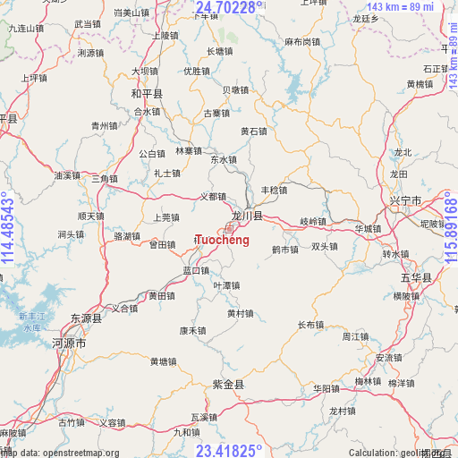
Tuocheng GPS coordinates[2]
24° 3' 42.732" North, 115° 11' 18.78" East
| Map corner | latitude | longitude |
|---|---|---|
| Upper-left | 24.70228°, | 114.48543° |
| Center: | 24.06187°, | 115.18855° |
| Lower-right: | 23.41825°, | 115.89168° |
| Map W x H: | 142.8×142.8 km | = 88.7×88.7mi |
| max Lat: | 53.31946° ⇑90.2% North |
| Tuocheng: | 24.06187° |
| min Lat: | ⇓9.8% South 18.22056° |
| min Long | Tuocheng | max Long |
| 75.07348° | 115.18855° | 134.28917° |
| W 55.3%⇐ | ⇒44.7% E |
Elevation
Elevation of Tuocheng is 65 m = 213 ft, and this is 419.8 m = 1377 ft below average elevation for this country.
| Max E: |
5622 m = 18445 ft | 66.8% |
| Avg. | 484.8 m = 1591 ft | |
| Tuocheng | 65 m = 213 ft | |
Min E: |
-3 m = -10 ft | 33.2% |
See also: China elevation on elevation.city.
Geographical zone
Tuocheng is located in North temperate zone (between Tropic of Cancer and the Arctic Circle). Distance of this Northern Tropic circle is 69.5 km =43.2 mi to South.| Distance of | km | miles | from Tuocheng |
|---|---|---|---|
| North Pole | 7331.6 | 4555.6 | to North |
| Arctic Circle | 4725.7 | 2936.4 | to North |
| Tropic Cancer | 69.5 | 43.2 | to South |
| Equator | 2675.4 | 1662.4 | to South |


Nearby cities:
15 places around Tuocheng: (largest is in red/bold)
• Dengyun
20.8 km =12.9 mi,  87°
87°
• Fengren
18.7 km =11.6 mi,  48°
48°
• Fucheng
6.1 km =3.8 mi, 45°
• Heshi
18.3 km =11.4 mi,  108°
108°
• Huangbu
14.5 km =9 mi,  128°
128°
• Lakou
16.6 km =10.3 mi,  221°
221°
• Lankou
16.3 km =10.1 mi, 220°
• Laolong
7.6 km =4.7 mi, 53°
• Liucheng
7.8 km =4.8 mi,  247°
247°
• Shangguan
20.9 km =13 mi,  281°
281°
• Sidu
18.2 km =11.3 mi,  20°
20°
• Tongqu
19.1 km =11.9 mi, 94°
• Yetan
17.2 km =10.7 mi,  183°
183°
• Yidu
11.8 km =7.3 mi,  333°
333°
• Zengtian
21.4 km =13.3 mi,  256°
256°
Sources, notices
• [Note1] Compared only with cities in China existing in our database
• [Src1] Map data: © OpenStreetMap contributors (CC-BY-SA)
• [Src2] Other city data from geonames.org with taken over terms of usage.
• [Src3] Geographical zone / Annual Mean Temperature by Robert A. Rohde @ Wikipedia
