Yaotang geodata
Yaotang (Jiangsu) is a seat of a fourth-order administrative division; located in China in Asia/Shanghai (GMT+8) time zone. In our database, there are 1268 cities with bigger population. Compared to other cities in China, 59.6% of cities are located further ↓South; 79.9% of cities are located further ←West and 94.3% of cities have higher elevation than Yaotang. Note1


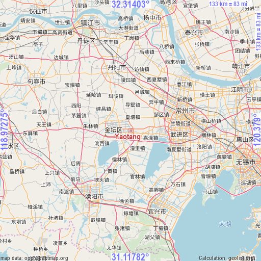
Yaotang GPS coordinates[2]
31° 43' 4.26" North, 119° 40' 33.132" East
| Map corner | latitude | longitude |
|---|---|---|
| Upper-left | 32.31403°, | 118.97275° |
| Center: | 31.71785°, | 119.67587° |
| Lower-right: | 31.11782°, | 120.379° |
| Map W x H: | 133×133 km | = 82.6×82.6mi |
| max Lat: | 53.31946° ⇑40.4% North |
| Yaotang: | 31.71785° |
| min Lat: | ⇓59.6% South 18.22056° |
| min Long | Yaotang | max Long |
| 75.07348° | 119.67587° | 134.28917° |
| W 79.9%⇐ | ⇒20.1% E |
Elevation
Elevation of Yaotang is 7 m = 23 ft, and this is 477.8 m = 1568 ft below average elevation for this country.
| Max E: |
5622 m = 18445 ft | 94.3% |
| Avg. | 484.8 m = 1591 ft | |
| Yaotang | 7 m = 23 ft | |
Min E: |
-3 m = -10 ft | 5.7% |
See also: China elevation on elevation.city.
Geographical zone
Yaotang is located in North temperate zone (between Tropic of Cancer and the Arctic Circle). Distance of this Northern Tropic circle is 920.8 km =572.2 mi to South.| Distance of | km | miles | from Yaotang |
|---|---|---|---|
| North Pole | 6480.4 | 4026.7 | to North |
| Arctic Circle | 3874.5 | 2407.5 | to North |
| Tropic Cancer | 920.8 | 572.2 | to South |
| Equator | 3526.7 | 2191.4 | to South |


Nearby cities:
15 places around Yaotang: (largest is in red/bold)
• Benniu
20.4 km =12.7 mi,  38°
38°
• Dashu
13.4 km =8.3 mi,  4°
4°
• Erling
19.5 km =12.1 mi,  337°
337°
• Huangli
9.8 km =6.1 mi,  159°
159°
• Huangtang
7.4 km =4.6 mi,  9°
9°
• Jianchang
20.6 km =12.8 mi,  303°
303°
• Jiaze
11 km =6.8 mi,  108°
108°
• Jincheng
10.1 km =6.3 mi,  286°
286°
• Liangpeng
17.6 km =10.9 mi, 157°
• Niutang
20.7 km =12.9 mi,  84°
84°
• Rulin
15.5 km =9.6 mi,  200°
200°
• Xilin
20.7 km =12.9 mi,  74°
74°
• Xinjian
17.4 km =10.8 mi,  185°
185°
• Yong’an
9.7 km =6 mi, 204°
• Zouqu
17.8 km =11.1 mi,  60°
60°
Sources, notices
• [Note1] Compared only with cities in China existing in our database
• [Src1] Map data: © OpenStreetMap contributors (CC-BY-SA)
• [Src2] Other city data from geonames.org with taken over terms of usage.
• [Src3] Geographical zone / Annual Mean Temperature by Robert A. Rohde @ Wikipedia
