Xintian geodata
Xintian (Anhui) is a seat of a fourth-order administrative division; located in China in Asia/Shanghai (GMT+8) time zone. In our database, there are 1268 cities with bigger population. Compared to other cities in China, 52.6% of cities are located further ↓South; 74.8% of cities are located further ←West and 60.8% of cities have higher elevation than Xintian. Note1


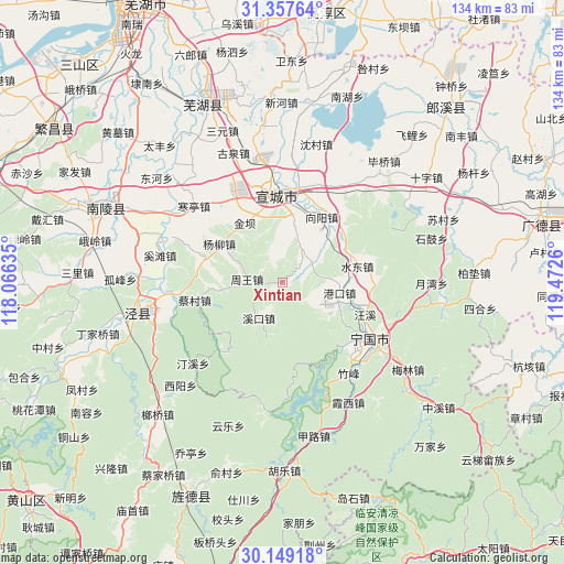
Xintian GPS coordinates[2]
30° 45' 19.116" North, 118° 46' 10.092" East
| Map corner | latitude | longitude |
|---|---|---|
| Upper-left | 31.35764°, | 118.06635° |
| Center: | 30.75531°, | 118.76947° |
| Lower-right: | 30.14918°, | 119.4726° |
| Map W x H: | 134.4×134.4 km | = 83.5×83.5mi |
| max Lat: | 53.31946° ⇑47.4% North |
| Xintian: | 30.75531° |
| min Lat: | ⇓52.6% South 18.22056° |
| min Long | Xintian | max Long |
| 75.07348° | 118.76947° | 134.28917° |
| W 74.8%⇐ | ⇒25.2% E |
Elevation
Elevation of Xintian is 94 m = 308 ft, and this is 390.8 m = 1282 ft below average elevation for this country.
| Max E: |
5622 m = 18445 ft | 60.8% |
| Avg. | 484.8 m = 1591 ft | |
| Xintian | 94 m = 308 ft | |
Min E: |
-3 m = -10 ft | 39.2% |
See also: China elevation on elevation.city.
Geographical zone
Xintian is located in North temperate zone (between Tropic of Cancer and the Arctic Circle). Distance of this Northern Tropic circle is 813.8 km =505.7 mi to South.| Distance of | km | miles | from Xintian |
|---|---|---|---|
| North Pole | 6587.4 | 4093.2 | to North |
| Arctic Circle | 3981.5 | 2474 | to North |
| Tropic Cancer | 813.8 | 505.7 | to South |
| Equator | 3419.7 | 2124.9 | to South |


Nearby cities:
15 places around Xintian: (largest is in red/bold)
• Aimin
18.9 km =11.7 mi,  230°
230°
• Caicun
21.4 km =13.3 mi,  258°
258°
• Gangkou
13.8 km =8.6 mi,  100°
100°
• Gaoqiao
19.4 km =12.1 mi,  284°
284°
• Guxi
10.4 km =6.5 mi,  214°
214°
• Jinba
16.7 km =10.4 mi,  325°
325°
• Qinglong
19.5 km =12.1 mi,  140°
140°
• Shuidong
18 km =11.2 mi,  78°
78°
• Sunbu
19.4 km =12.1 mi,  33°
33°
• Wangxi
20.9 km =13 mi,  111°
111°
• Xiadu
18.7 km =11.6 mi,  2°
2°
• Xiangyang
18.2 km =11.3 mi, 30°
• Yangliu
17.6 km =10.9 mi,  301°
301°
• Yishan
9.2 km =5.7 mi, 29°
• Zhouwang
8.3 km =5.2 mi,  273°
273°
Sources, notices
• [Note1] Compared only with cities in China existing in our database
• [Src1] Map data: © OpenStreetMap contributors (CC-BY-SA)
• [Src2] Other city data from geonames.org with taken over terms of usage.
• [Src3] Geographical zone / Annual Mean Temperature by Robert A. Rohde @ Wikipedia
