Xiaoxi geodata
Xiaoxi (Fujian) is a seat of a third-order administrative division; located in China in Asia/Shanghai (GMT+8) time zone. In our database, there are 1268 cities with bigger population. Compared to other cities in China, 89% of cities are located further ↑North; 67.7% of cities are located further ←West and 54.2% of cities have higher elevation than Xiaoxi. Note1


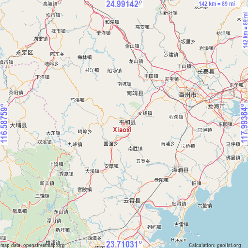
Xiaoxi GPS coordinates[2]
24° 21' 8.964" North, 117° 17' 26.556" East
| Map corner | latitude | longitude |
|---|---|---|
| Upper-left | 24.99142°, | 116.58759° |
| Center: | 24.35249°, | 117.29071° |
| Lower-right: | 23.71031°, | 117.99384° |
| Map W x H: | 142.4×142.4 km | = 88.5×88.5mi |
| max Lat: | 53.31946° ⇑89% North |
| Xiaoxi: | 24.35249° |
| min Lat: | ⇓11% South 18.22056° |
| min Long | Xiaoxi | max Long |
| 75.07348° | 117.29071° | 134.28917° |
| W 67.7%⇐ | ⇒32.3% E |
Elevation
Elevation of Xiaoxi is 136 m = 446 ft, and this is 348.8 m = 1144 ft below average elevation for this country.
| Max E: |
5622 m = 18445 ft | 54.2% |
| Avg. | 484.8 m = 1591 ft | |
| Xiaoxi | 136 m = 446 ft | |
Min E: |
-3 m = -10 ft | 45.8% |
See also: China elevation on elevation.city.
Geographical zone
Xiaoxi is located in North temperate zone (between Tropic of Cancer and the Arctic Circle). Distance of this Northern Tropic circle is 101.8 km =63.3 mi to South.| Distance of | km | miles | from Xiaoxi |
|---|---|---|---|
| North Pole | 7299.3 | 4535.6 | to North |
| Arctic Circle | 4693.4 | 2916.3 | to North |
| Tropic Cancer | 101.8 | 63.3 | to South |
| Equator | 2707.7 | 1682.5 | to South |


Nearby cities:
15 places around Xiaoxi: (largest is in red/bold)
• Changle
36.5 km =22.7 mi,  259°
259°
• Dadong
41 km =25.5 mi, 263°
• Dongkeng
45.7 km =28.4 mi,  168°
168°
• Hushan
44.2 km =27.5 mi,  287°
287°
• Nanpu
28.1 km =17.5 mi,  112°
112°
• Shancheng
16.4 km =10.2 mi,  19°
19°
• Shangrao
44.7 km =27.8 mi,  239°
239°
• Shuangxi
46.8 km =29.1 mi, 257°
• Sui’an
43.7 km =27.2 mi,  132°
132°
• Xiahe
37.5 km =23.3 mi,  182°
182°
• Xiufeng
31.4 km =19.5 mi,  265°
265°
• Xiuzhuan
43.1 km =26.8 mi,  230°
230°
• Yunling
44.6 km =27.7 mi, 174°
• Zhaizipu
44.1 km =27.4 mi, 183°
• Zhangzhou
41 km =25.5 mi,  64°
64°
Sources, notices
• [Note1] Compared only with cities in China existing in our database
• [Src1] Map data: © OpenStreetMap contributors (CC-BY-SA)
• [Src2] Other city data from geonames.org with taken over terms of usage.
• [Src3] Geographical zone / Annual Mean Temperature by Robert A. Rohde @ Wikipedia
