Xiaoping geodata
Xiaoping (Hunan) is a populated place; located in China in Asia/Shanghai (GMT+8) time zone. With population of 690 people, there are 1235 cities with bigger population in this country. Compared to other cities in China, 77.2% of cities are located further ↑North; 72.8% of cities are located further →East and 64.3% of cities have lower elevation than Xiaoping. Note1


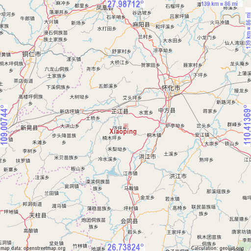
Xiaoping GPS coordinates[2]
27° 21' 51.984" North, 109° 42' 38.016" East
| Map corner | latitude | longitude |
|---|---|---|
| Upper-left | 27.98712°, | 109.00744° |
| Center: | 27.36444°, | 109.71056° |
| Lower-right: | 26.73824°, | 110.41369° |
| Map W x H: | 138.9×138.9 km | = 86.3×86.3mi |
| max Lat: | 53.31946° ⇑77.2% North |
| Xiaoping: | 27.36444° |
| min Lat: | ⇓22.8% South 18.22056° |
| min Long | Xiaoping | max Long |
| 75.07348° | 109.71056° | 134.28917° |
| W 27.2%⇐ | ⇒72.8% E |
Elevation
Elevation of Xiaoping is 315 m = 1033 ft, and this is 169.8 m = 557 ft below average elevation for this country.
| Max E: |
5622 m = 18445 ft | 35.7% |
| Avg. | 484.8 m = 1591 ft | |
| Xiaoping | 315 m = 1033 ft | |
Min E: |
-3 m = -10 ft | 64.3% |
See also: China elevation on elevation.city.
Geographical zone
Xiaoping is located in North temperate zone (between Tropic of Cancer and the Arctic Circle). Distance of this Northern Tropic circle is 436.7 km =271.4 mi to South.| Distance of | km | miles | from Xiaoping |
|---|---|---|---|
| North Pole | 6964.4 | 4327.5 | to North |
| Arctic Circle | 4358.5 | 2708.2 | to North |
| Tropic Cancer | 436.7 | 271.4 | to South |
| Equator | 3042.6 | 1890.6 | to South |


Nearby cities:
15 places around Xiaoping: (largest is in red/bold)
• Biyong
27.9 km =17.3 mi,  225°
225°
• Huaihua
36.4 km =22.6 mi,  52°
52°
• Jiangkouxu
36.7 km =22.8 mi,  3°
3°
• Jiangshi
26.9 km =16.7 mi,  174°
174°
• Luojiu
19.4 km =12.1 mi,  29°
29°
• Mobin Tongzumiaozuxiang
36.5 km =22.7 mi,  205°
205°
• Nanmuping
6.7 km =4.2 mi, 208°
• Pailou’ao
20.7 km =12.9 mi,  97°
97°
• Qiancheng
20.7 km =12.9 mi,  164°
164°
• Shawan
36.3 km =22.6 mi,  120°
120°
• Shuangxi
20.9 km =13 mi,  136°
136°
• Tuokou
28 km =17.4 mi,  197°
197°
• Yaoshi
35.4 km =22 mi,  329°
329°
• Zhijiang
11.6 km =7.2 mi, 334°
• Zhongfang
22.5 km =14 mi,  76°
76°
Sources, notices
• [Note1] Compared only with cities in China existing in our database
• [Src1] Map data: © OpenStreetMap contributors (CC-BY-SA)
• [Src2] Other city data from geonames.org with taken over terms of usage.
• [Src3] Geographical zone / Annual Mean Temperature by Robert A. Rohde @ Wikipedia
