Jiangshi geodata
Jiangshi (Hunan) is a populated place; located in China in Asia/Shanghai (GMT+8) time zone. With population of 1,510 people, there are 1085 cities with bigger population in this country. Compared to other cities in China, 78.1% of cities are located further ↑North; 72.6% of cities are located further →East and 54% of cities have lower elevation than Jiangshi. Note1


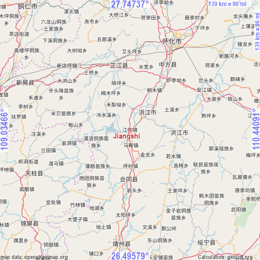
Jiangshi GPS coordinates[2]
27° 7' 23.988" North, 109° 44' 16.008" East
| Map corner | latitude | longitude |
|---|---|---|
| Upper-left | 27.74737°, | 109.03466° |
| Center: | 27.12333°, | 109.73778° |
| Lower-right: | 26.49579°, | 110.44091° |
| Map W x H: | 139.2×139.2 km | = 86.5×86.5mi |
| max Lat: | 53.31946° ⇑78.1% North |
| Jiangshi: | 27.12333° |
| min Lat: | ⇓21.9% South 18.22056° |
| min Long | Jiangshi | max Long |
| 75.07348° | 109.73778° | 134.28917° |
| W 27.4%⇐ | ⇒72.6% E |
Elevation
Elevation of Jiangshi is 197 m = 646 ft, and this is 287.8 m = 944 ft below average elevation for this country.
| Max E: |
5622 m = 18445 ft | 46% |
| Avg. | 484.8 m = 1591 ft | |
| Jiangshi | 197 m = 646 ft | |
Min E: |
-3 m = -10 ft | 54% |
See also: China elevation on elevation.city.
Geographical zone
Jiangshi is located in North temperate zone (between Tropic of Cancer and the Arctic Circle). Distance of this Northern Tropic circle is 409.9 km =254.7 mi to South.| Distance of | km | miles | from Jiangshi |
|---|---|---|---|
| North Pole | 6991.2 | 4344.1 | to North |
| Arctic Circle | 4385.3 | 2724.9 | to North |
| Tropic Cancer | 409.9 | 254.7 | to South |
| Equator | 3015.8 | 1873.9 | to South |


Nearby cities:
15 places around Jiangshi: (largest is in red/bold)
• Biyong
23.6 km =14.7 mi,  287°
287°
• Gaoyi
33 km =20.5 mi,  123°
123°
• Hongjiang
25.6 km =15.9 mi,  93°
93°
• Jiangdong
31.7 km =19.7 mi,  241°
241°
• Lincheng
29.2 km =18.1 mi,  194°
194°
• Mobin Tongzumiaozuxiang
19.2 km =11.9 mi,  250°
250°
• Nanmuping
21.7 km =13.5 mi,  344°
344°
• Pailou’ao
30 km =18.6 mi,  36°
36°
• Puzi
15.7 km =9.8 mi,  165°
165°
• Qiancheng
7.4 km =4.6 mi,  21°
21°
• Ruoshui
26.4 km =16.4 mi, 120°
• Shawan
30 km =18.6 mi,  73°
73°
• Shuangxi
16.5 km =10.3 mi,  45°
45°
• Tuokou
11.2 km =7 mi,  270°
270°
• Xiaoping
26.9 km =16.7 mi,  354°
354°
Sources, notices
• [Note1] Compared only with cities in China existing in our database
• [Src1] Map data: © OpenStreetMap contributors (CC-BY-SA)
• [Src2] Other city data from geonames.org with taken over terms of usage.
• [Src3] Geographical zone / Annual Mean Temperature by Robert A. Rohde @ Wikipedia
