Heshikou geodata
Heshikou (Hunan) is a seat of a fourth-order administrative division; located in China in Asia/Shanghai (GMT+8) time zone. In our database, there are 1268 cities with bigger population. Compared to other cities in China, 72.2% of cities are located further ↑North; 51% of cities are located further →East and 54.2% of cities have lower elevation than Heshikou. Note1


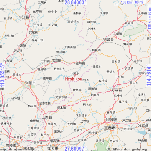
Heshikou GPS coordinates[2]
28° 13' 20.28" North, 114° 3' 29.772" East
| Map corner | latitude | longitude |
|---|---|---|
| Upper-left | 28.84003°, | 113.35515° |
| Center: | 28.2223°, | 114.05827° |
| Lower-right: | 27.60097°, | 114.7614° |
| Map W x H: | 137.8×137.8 km | = 85.6×85.6mi |
| max Lat: | 53.31946° ⇑72.2% North |
| Heshikou: | 28.2223° |
| min Lat: | ⇓27.8% South 18.22056° |
| min Long | Heshikou | max Long |
| 75.07348° | 114.05827° | 134.28917° |
| W 49%⇐ | ⇒51% E |
Elevation
Elevation of Heshikou is 199 m = 653 ft, and this is 285.8 m = 938 ft below average elevation for this country.
| Max E: |
5622 m = 18445 ft | 45.8% |
| Avg. | 484.8 m = 1591 ft | |
| Heshikou | 199 m = 653 ft | |
Min E: |
-3 m = -10 ft | 54.2% |
See also: China elevation on elevation.city.
Geographical zone
Heshikou is located in North temperate zone (between Tropic of Cancer and the Arctic Circle). Distance of this Northern Tropic circle is 532.1 km =330.6 mi to South.| Distance of | km | miles | from Heshikou |
|---|---|---|---|
| North Pole | 6869 | 4268.2 | to North |
| Arctic Circle | 4263.1 | 2649 | to North |
| Tropic Cancer | 532.1 | 330.6 | to South |
| Equator | 3138 | 1949.9 | to South |


Nearby cities:
15 places around Heshikou: (largest is in red/bold)
• Baisha
27.9 km =17.3 mi,  5°
5°
• Baishui
8.9 km =5.5 mi,  113°
113°
• Chixing
17.7 km =11 mi,  94°
94°
• Cihua
23.5 km =14.6 mi,  187°
187°
• Daweishan
27.1 km =16.8 mi,  349°
349°
• Gaocheng
31.5 km =19.6 mi,  115°
115°
• Huangmao
12.8 km =8 mi,  173°
173°
• Lingdong
25.1 km =15.6 mi,  134°
134°
• Nanmu
28.1 km =17.5 mi,  157°
157°
• Paibu
30 km =18.6 mi,  38°
38°
• Shuangqiao
25.3 km =15.7 mi,  99°
99°
• Tanbu
19.4 km =12.1 mi, 127°
• Xianyuan
21.4 km =13.3 mi,  66°
66°
• Zhangfang
12.5 km =7.8 mi,  20°
20°
• Zhutan
21.4 km =13.3 mi,  152°
152°
Sources, notices
• [Note1] Compared only with cities in China existing in our database
• [Src1] Map data: © OpenStreetMap contributors (CC-BY-SA)
• [Src2] Other city data from geonames.org with taken over terms of usage.
• [Src3] Geographical zone / Annual Mean Temperature by Robert A. Rohde @ Wikipedia
