Weiyuan geodata
Weiyuan (Yunnan) is a seat of a third-order administrative division; located in China in Asia/Shanghai (GMT+8) time zone. In our database, there are 1268 cities with bigger population. Compared to other cities in China, 92.3% of cities are located further ↑North; 94% of cities are located further →East and 84.2% of cities have lower elevation than Weiyuan. Note1


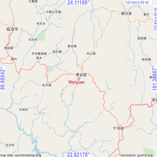
Weiyuan GPS coordinates[2]
23° 28' 5.916" North, 100° 41' 0.744" East
| Map corner | latitude | longitude |
|---|---|---|
| Upper-left | 24.11169°, | 99.98042° |
| Center: | 23.46831°, | 100.68354° |
| Lower-right: | 22.82178°, | 101.38667° |
| Map W x H: | 143.4×143.4 km | = 89.1×89.1mi |
| max Lat: | 53.31946° ⇑92.3% North |
| Weiyuan: | 23.46831° |
| min Lat: | ⇓7.7% South 18.22056° |
| min Long | Weiyuan | max Long |
| 75.07348° | 100.68354° | 134.28917° |
| W 6%⇐ | ⇒94% E |
Elevation
Elevation of Weiyuan is 929 m = 3048 ft, and this is 444.2 m = 1457 ft above average elevation for this country.
| Max E: |
5622 m = 18445 ft | 15.8% |
| Weiyuan | 929 m 3048 ft | |
| Avg. | 484.8 m = 1591 ft | |
Min E: |
-3 m = -10 ft | 84.2% |
See also: China elevation on elevation.city.
Geographical zone
Weiyuan is located in North temperate zone (between Tropic of Cancer and the Arctic Circle). Distance of this Northern Tropic circle is 3.5 km =2.2 mi to South.| Distance of | km | miles | from Weiyuan |
|---|---|---|---|
| North Pole | 7397.6 | 4596.7 | to North |
| Arctic Circle | 4791.7 | 2977.4 | to North |
| Tropic Cancer | 3.5 | 2.2 | to South |
| Equator | 2609.4 | 1621.4 | to South |


Nearby cities:
15 places around Weiyuan: (largest is in red/bold)
• Aihua
121 km =75.2 mi,  330°
330°
• Enle
68.2 km =42.4 mi,  36°
36°
• Fengshan
147.3 km =91.5 mi, 327°
• Gengma
133.2 km =82.8 mi,  272°
272°
• Guishan
148.8 km =92.5 mi,  64°
64°
• Jinping
108.2 km =67.2 mi,  7°
7°
• Lianzhu
105 km =65.2 mi,  93°
93°
• Lijiang
135.1 km =83.9 mi, 85°
• Liushun
93.5 km =58.1 mi,  177°
177°
• Mengdong
155.1 km =96.4 mi,  257°
257°
• Menglang
128.1 km =79.6 mi,  218°
218°
• Mengmeng
89.9 km =55.9 mi, 269°
• Mengsuo
150.7 km =93.6 mi,  230°
230°
• Ning’er
59.7 km =37.1 mi,  142°
142°
• Simao
81.2 km =50.5 mi,  158°
158°
Sources, notices
• [Note1] Compared only with cities in China existing in our database
• [Src1] Map data: © OpenStreetMap contributors (CC-BY-SA)
• [Src2] Other city data from geonames.org with taken over terms of usage.
• [Src3] Geographical zone / Annual Mean Temperature by Robert A. Rohde @ Wikipedia
