Mengsuo geodata
Mengsuo (Yunnan) is a seat of a third-order administrative division; located in China in Asia/Shanghai (GMT+8) time zone. In our database, there are 1268 cities with bigger population. Compared to other cities in China, 96% of cities are located further ↑North; 94.8% of cities are located further →East and 90% of cities have lower elevation than Mengsuo. Note1


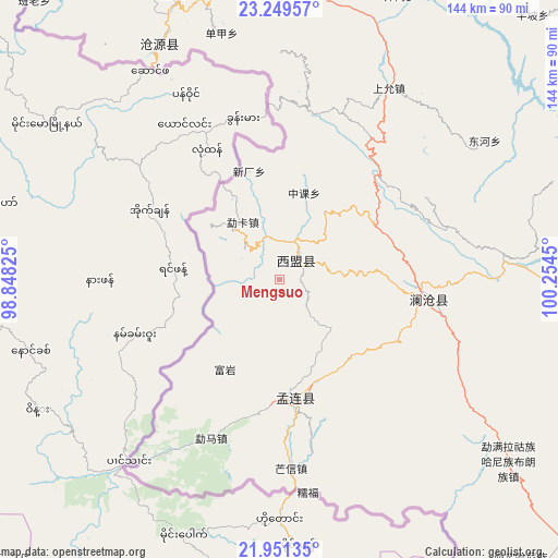
Mengsuo GPS coordinates[2]
22° 36' 7.164" North, 99° 33' 4.932" East
| Map corner | latitude | longitude |
|---|---|---|
| Upper-left | 23.24957°, | 98.84825° |
| Center: | 22.60199°, | 99.55137° |
| Lower-right: | 21.95135°, | 100.2545° |
| Map W x H: | 144.3×144.4 km | = 89.7×89.7mi |
| max Lat: | 53.31946° ⇑96% North |
| Mengsuo: | 22.60199° |
| min Lat: | ⇓4% South 18.22056° |
| min Long | Mengsuo | max Long |
| 75.07348° | 99.55137° | 134.28917° |
| W 5.2%⇐ | ⇒94.8% E |
Elevation
Elevation of Mengsuo is 1365 m = 4478 ft, and this is 880.2 m = 2888 ft above average elevation for this country.
| Max E: |
5622 m = 18445 ft | 10% |
| Mengsuo | 1365 m 4478 ft | |
| Avg. | 484.8 m = 1591 ft | |
Min E: |
-3 m = -10 ft | 90% |
See also: China elevation on elevation.city.
Geographical zone
Mengsuo is located in North Torrid zone (between Equator and Tropic of Cancer). Distance of this Northern Tropic circle is 92.8 km =57.7 mi to North.| Distance of | km | miles | from Mengsuo |
|---|---|---|---|
| North Pole | 7494 | 4656.6 | to North |
| Arctic Circle | 4888.1 | 3037.3 | to North |
| Tropic Cancer | 92.8 | 57.7 | to North |
| Equator | 2513.1 | 1561.6 | to South |


Nearby cities:
15 places around Mengsuo: (largest is in red/bold)
• Aihua
209.4 km =130.1 mi,  15°
15°
• Dedang
160 km =99.4 mi,  348°
348°
• Enle
217.4 km =135.1 mi,  45°
45°
• Gengma
103.9 km =64.6 mi, 350°
• Jinghong
139.4 km =86.6 mi,  119°
119°
• Liushun
120.4 km =74.8 mi,  88°
88°
• Mengdong
71.8 km =44.6 mi,  330°
330°
• Menghai
112 km =69.6 mi,  130°
130°
• Menglang
37.1 km =23.1 mi,  96°
96°
• Mengmeng
99.3 km =61.7 mi,  14°
14°
• Nansan
153.1 km =95.1 mi, 330°
• Nayun
30 km =18.6 mi,  178°
178°
• Ning’er
159.9 km =99.4 mi,  72°
72°
• Simao
147.5 km =91.7 mi,  81°
81°
• Weiyuan
150.7 km =93.6 mi, 50°
Sources, notices
• [Note1] Compared only with cities in China existing in our database
• [Src1] Map data: © OpenStreetMap contributors (CC-BY-SA)
• [Src2] Other city data from geonames.org with taken over terms of usage.
• [Src3] Geographical zone / Annual Mean Temperature by Robert A. Rohde @ Wikipedia
