Wansheng geodata
Wansheng (Chongqing) is a seat of a third-order administrative division; located in China in Asia/Shanghai (GMT+8) time zone. In our database, there are 1268 cities with bigger population. Compared to other cities in China, 65.8% of cities are located further ↑North; 83.9% of cities are located further →East and 64.9% of cities have lower elevation than Wansheng. Note1


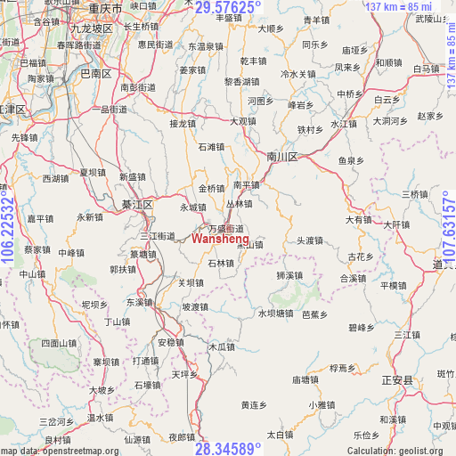
Wansheng GPS coordinates[2]
28° 57' 46.44" North, 106° 55' 42.384" East
| Map corner | latitude | longitude |
|---|---|---|
| Upper-left | 29.57625°, | 106.22532° |
| Center: | 28.9629°, | 106.92844° |
| Lower-right: | 28.34589°, | 107.63157° |
| Map W x H: | 136.8×136.8 km | = 85×85mi |
| max Lat: | 53.31946° ⇑65.8% North |
| Wansheng: | 28.9629° |
| min Lat: | ⇓34.2% South 18.22056° |
| min Long | Wansheng | max Long |
| 75.07348° | 106.92844° | 134.28917° |
| W 16.1%⇐ | ⇒83.9% E |
Elevation
Elevation of Wansheng is 324 m = 1063 ft, and this is 160.8 m = 528 ft below average elevation for this country.
| Max E: |
5622 m = 18445 ft | 35.1% |
| Avg. | 484.8 m = 1591 ft | |
| Wansheng | 324 m = 1063 ft | |
Min E: |
-3 m = -10 ft | 64.9% |
See also: China elevation on elevation.city.
Geographical zone
Wansheng is located in North temperate zone (between Tropic of Cancer and the Arctic Circle). Distance of this Northern Tropic circle is 614.5 km =381.8 mi to South.| Distance of | km | miles | from Wansheng |
|---|---|---|---|
| North Pole | 6786.7 | 4217.1 | to North |
| Arctic Circle | 4180.8 | 2597.8 | to North |
| Tropic Cancer | 614.5 | 381.8 | to South |
| Equator | 3220.4 | 2001.1 | to South |


Nearby cities:
15 places around Wansheng: (largest is in red/bold)
• Conglin
8.5 km =5.3 mi,  28°
28°
• Guanba
21.5 km =13.4 mi,  213°
213°
• Jinqiao
10.4 km =6.5 mi,  336°
336°
• Jinshan
17.5 km =10.9 mi,  101°
101°
• Longsheng
17.1 km =10.6 mi,  320°
320°
• Nantong
7 km =4.3 mi,  236°
236°
• Puhechang
9.5 km =5.9 mi,  263°
263°
• Sanjiang
21.3 km =13.2 mi, 264°
• Sanjiao
21.1 km =13.1 mi,  297°
297°
• Shentong
24 km =14.9 mi,  0°
0°
• Shijiaochang
17.3 km =10.7 mi, 255°
• Shilin
10 km =6.2 mi,  194°
194°
• Shitan
24.1 km =15 mi,  349°
349°
• Shixi
23 km =14.3 mi,  126°
126°
• Toudu
24.8 km =15.4 mi, 96°
Sources, notices
• [Note1] Compared only with cities in China existing in our database
• [Src1] Map data: © OpenStreetMap contributors (CC-BY-SA)
• [Src2] Other city data from geonames.org with taken over terms of usage.
• [Src3] Geographical zone / Annual Mean Temperature by Robert A. Rohde @ Wikipedia
