Puhechang geodata
Puhechang (Chongqing) is a populated place; located in China in Asia/Shanghai (GMT+8) time zone. With population of 1,600 people, there are 1075 cities with bigger population in this country. Compared to other cities in China, 65.9% of cities are located further ↑North; 84.2% of cities are located further →East and 63.5% of cities have lower elevation than Puhechang. Note1


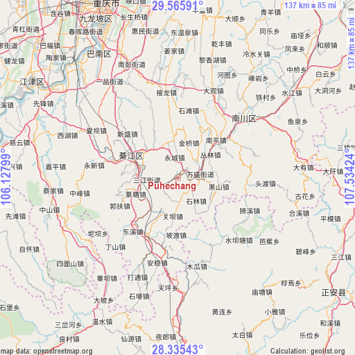
Puhechang GPS coordinates[2]
28° 57' 9" North, 106° 49' 51.996" East
| Map corner | latitude | longitude |
|---|---|---|
| Upper-left | 29.56591°, | 106.12799° |
| Center: | 28.9525°, | 106.83111° |
| Lower-right: | 28.33543°, | 107.53424° |
| Map W x H: | 136.8×136.8 km | = 85×85mi |
| max Lat: | 53.31946° ⇑65.9% North |
| Puhechang: | 28.9525° |
| min Lat: | ⇓34.1% South 18.22056° |
| min Long | Puhechang | max Long |
| 75.07348° | 106.83111° | 134.28917° |
| W 15.8%⇐ | ⇒84.2% E |
Elevation
Elevation of Puhechang is 304 m = 997 ft, and this is 180.8 m = 593 ft below average elevation for this country.
| Max E: |
5622 m = 18445 ft | 36.5% |
| Avg. | 484.8 m = 1591 ft | |
| Puhechang | 304 m = 997 ft | |
Min E: |
-3 m = -10 ft | 63.5% |
See also: China elevation on elevation.city.
Geographical zone
Puhechang is located in North temperate zone (between Tropic of Cancer and the Arctic Circle). Distance of this Northern Tropic circle is 613.3 km =381.1 mi to South.| Distance of | km | miles | from Puhechang |
|---|---|---|---|
| North Pole | 6787.8 | 4217.7 | to North |
| Arctic Circle | 4182 | 2598.6 | to North |
| Tropic Cancer | 613.3 | 381.1 | to South |
| Equator | 3219.2 | 2000.3 | to South |


Nearby cities:
15 places around Puhechang: (largest is in red/bold)
• Conglin
16.1 km =10 mi,  57°
57°
• Guanba
16.9 km =10.5 mi,  188°
188°
• Gunan
19.5 km =12.1 mi,  293°
293°
• Guofuchang
25.1 km =15.6 mi,  242°
242°
• Hengshan
23.6 km =14.7 mi,  319°
319°
• Jinqiao
11.9 km =7.4 mi,  26°
26°
• Longsheng
14.4 km =8.9 mi,  354°
354°
• Nantong
4.5 km =2.8 mi,  126°
126°
• Podu
22.1 km =13.7 mi,  181°
181°
• Sanjiang
11.8 km =7.3 mi,  265°
265°
• Sanjiao
14.2 km =8.8 mi, 319°
• Shijiaochang
7.9 km =4.9 mi,  246°
246°
• Shilin
10.9 km =6.8 mi,  140°
140°
• Shitan
25.4 km =15.8 mi,  11°
11°
• Wansheng
9.5 km =5.9 mi,  83°
83°
Sources, notices
• [Note1] Compared only with cities in China existing in our database
• [Src1] Map data: © OpenStreetMap contributors (CC-BY-SA)
• [Src2] Other city data from geonames.org with taken over terms of usage.
• [Src3] Geographical zone / Annual Mean Temperature by Robert A. Rohde @ Wikipedia
