Tuanlinpu geodata
Tuanlinpu (Hubei) is a seat of a fourth-order administrative division; located in China in Asia/Shanghai (GMT+8) time zone. In our database, there are 1268 cities with bigger population. Compared to other cities in China, 53.7% of cities are located further ↓South; 61.8% of cities are located further →East and 59.7% of cities have higher elevation than Tuanlinpu. Note1


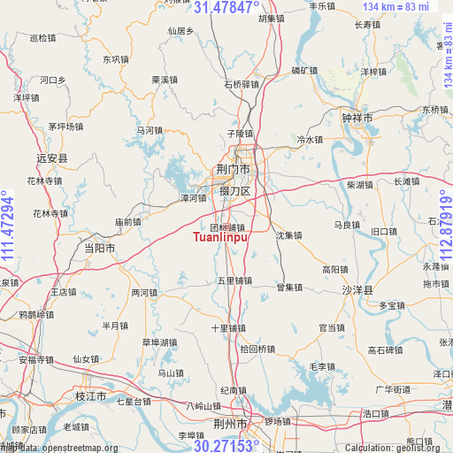
Tuanlinpu GPS coordinates[2]
30° 52' 36.84" North, 112° 10' 33.816" East
| Map corner | latitude | longitude |
|---|---|---|
| Upper-left | 31.47847°, | 111.47294° |
| Center: | 30.8769°, | 112.17606° |
| Lower-right: | 30.27153°, | 112.87919° |
| Map W x H: | 134.2×134.2 km | = 83.4×83.4mi |
| max Lat: | 53.31946° ⇑46.3% North |
| Tuanlinpu: | 30.8769° |
| min Lat: | ⇓53.7% South 18.22056° |
| min Long | Tuanlinpu | max Long |
| 75.07348° | 112.17606° | 134.28917° |
| W 38.2%⇐ | ⇒61.8% E |
Elevation
Elevation of Tuanlinpu is 100 m = 328 ft, and this is 384.8 m = 1262 ft below average elevation for this country.
| Max E: |
5622 m = 18445 ft | 59.7% |
| Avg. | 484.8 m = 1591 ft | |
| Tuanlinpu | 100 m = 328 ft | |
Min E: |
-3 m = -10 ft | 40.3% |
See also: China elevation on elevation.city.
Geographical zone
Tuanlinpu is located in North temperate zone (between Tropic of Cancer and the Arctic Circle). Distance of this Northern Tropic circle is 827.3 km =514.1 mi to South.| Distance of | km | miles | from Tuanlinpu |
|---|---|---|---|
| North Pole | 6573.9 | 4084.8 | to North |
| Arctic Circle | 3968 | 2465.6 | to North |
| Tropic Cancer | 827.3 | 514.1 | to South |
| Equator | 3433.2 | 2133.3 | to South |


Nearby cities:
15 places around Tuanlinpu: (largest is in red/bold)
• Baimiao
18.1 km =11.2 mi,  13°
13°
• Duodaoshi
9.5 km =5.9 mi, 5°
• Herong
27.1 km =16.8 mi,  225°
225°
• Jingmen
17.6 km =10.9 mi, 8°
• Lianghe
31 km =19.3 mi, 231°
• Macheng
11.4 km =7.1 mi,  71°
71°
• Miaoqian
29.1 km =18.1 mi,  273°
273°
• Pailou
22.2 km =13.8 mi,  27°
27°
• Shenji
18.5 km =11.5 mi,  96°
96°
• Shilipu
29.8 km =18.5 mi,  179°
179°
• Shipai
33.3 km =20.7 mi, 68°
• Wulipu
15.7 km =9.8 mi,  171°
171°
• Zengji
25.4 km =15.8 mi,  133°
133°
• Zhanghe
13.4 km =8.3 mi,  311°
311°
• Zilingpu
28.6 km =17.8 mi, 8°
Sources, notices
• [Note1] Compared only with cities in China existing in our database
• [Src1] Map data: © OpenStreetMap contributors (CC-BY-SA)
• [Src2] Other city data from geonames.org with taken over terms of usage.
• [Src3] Geographical zone / Annual Mean Temperature by Robert A. Rohde @ Wikipedia
