Shipai geodata
Shipai (Hubei) is a seat of a fourth-order administrative division; located in China in Asia/Shanghai (GMT+8) time zone. In our database, there are 1268 cities with bigger population. Compared to other cities in China, 54.7% of cities are located further ↓South; 60% of cities are located further →East and 71% of cities have higher elevation than Shipai. Note1


Shipai GPS coordinates[2]
30° 59' 11.004" North, 112° 30' 3.132" East
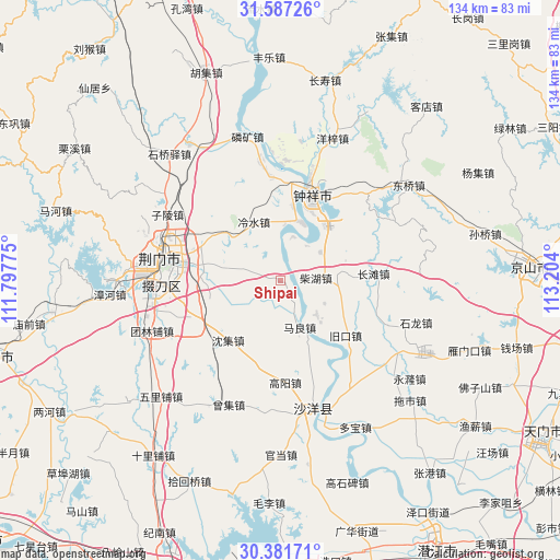
| Map corner | latitude | longitude |
|---|---|---|
| Upper-left | 31.58726°, | 111.79775° |
| Center: | 30.98639°, | 112.50087° |
| Lower-right: | 30.38171°, | 113.204° |
| Map W x H: | 134×134 km | = 83.3×83.3mi |
| max Lat: | 53.31946° ⇑45.3% North |
| Shipai: | 30.98639° |
| min Lat: | ⇓54.7% South 18.22056° |
| min Long | Shipai | max Long |
| 75.07348° | 112.50087° | 134.28917° |
| W 40%⇐ | ⇒60% E |
Elevation
Elevation of Shipai is 48 m = 157 ft, and this is 436.8 m = 1433 ft below average elevation for this country.
| Max E: |
5622 m = 18445 ft | 71% |
| Avg. | 484.8 m = 1591 ft | |
| Shipai | 48 m = 157 ft | |
Min E: |
-3 m = -10 ft | 29% |
See also: China elevation on elevation.city.
Geographical zone
Shipai is located in North temperate zone (between Tropic of Cancer and the Arctic Circle). Distance of this Northern Tropic circle is 839.4 km =521.6 mi to South.| Distance of | km | miles | from Shipai |
|---|---|---|---|
| North Pole | 6561.7 | 4077.3 | to North |
| Arctic Circle | 3955.8 | 2458 | to North |
| Tropic Cancer | 839.4 | 521.6 | to South |
| Equator | 3445.4 | 2140.9 | to South |


Nearby cities:
15 places around Shipai: (largest is in red/bold)
• Baimiao
27.2 km =16.9 mi,  281°
281°
• Chaihu
8.5 km =5.3 mi,  85°
85°
• Changtan
22.2 km =13.8 mi, 85°
• Duodaoshi
30.3 km =18.8 mi,  264°
264°
• Gaoyang
24.5 km =15.2 mi,  177°
177°
• Jingmen
28.7 km =17.8 mi, 280°
• Jiukou
20.8 km =12.9 mi,  130°
130°
• Lengshui
15.3 km =9.5 mi,  335°
335°
• Macheng
21.9 km =13.6 mi,  246°
246°
• Maliang
12.1 km =7.5 mi,  158°
158°
• Pailou
22.2 km =13.8 mi,  289°
289°
• Shenji
19.1 km =11.9 mi,  221°
221°
• Wenji
19.3 km =12 mi,  7°
7°
• Zhongxiang
21.5 km =13.4 mi,  21°
21°
• Zilingpu
31.4 km =19.5 mi,  300°
300°
Sources, notices
• [Note1] Compared only with cities in China existing in our database
• [Src1] Map data: © OpenStreetMap contributors (CC-BY-SA)
• [Src2] Other city data from geonames.org with taken over terms of usage.
• [Src3] Geographical zone / Annual Mean Temperature by Robert A. Rohde @ Wikipedia
