Jingmen geodata
Jingmen (Hubei) is a seat of a second-order administrative division; located in China in Asia/Shanghai (GMT+8) time zone. With population of 167,750 people, there are 264 cities with bigger population in this country. Compared to other cities in China, 55.1% of cities are located further ↓South; 61.6% of cities are located further →East and 60.8% of cities have higher elevation than Jingmen. Note1


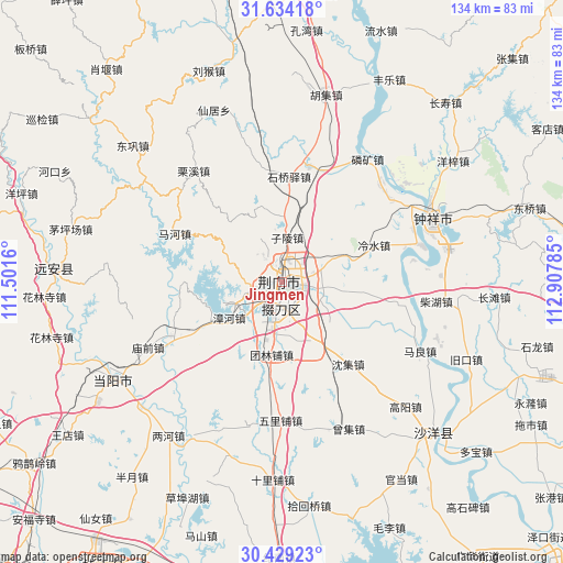
Jingmen GPS coordinates[2]
31° 2' 0.996" North, 112° 12' 16.992" East
| Map corner | latitude | longitude |
|---|---|---|
| Upper-left | 31.63418°, | 111.5016° |
| Center: | 31.03361°, | 112.20472° |
| Lower-right: | 30.42923°, | 112.90785° |
| Map W x H: | 134×134 km | = 83.3×83.3mi |
| max Lat: | 53.31946° ⇑44.9% North |
| Jingmen: | 31.03361° |
| min Lat: | ⇓55.1% South 18.22056° |
| min Long | Jingmen | max Long |
| 75.07348° | 112.20472° | 134.28917° |
| W 38.4%⇐ | ⇒61.6% E |
Elevation
Elevation of Jingmen is 94 m = 308 ft, and this is 390.8 m = 1282 ft below average elevation for this country.
| Max E: |
5622 m = 18445 ft | 60.8% |
| Avg. | 484.8 m = 1591 ft | |
| Jingmen | 94 m = 308 ft | |
Min E: |
-3 m = -10 ft | 39.2% |
See also: Jingmen elevation on elevation.city.
Geographical zone
Jingmen is located in North temperate zone (between Tropic of Cancer and the Arctic Circle). Distance of this Northern Tropic circle is 844.7 km =524.9 mi to South.| Distance of | km | miles | from Jingmen |
|---|---|---|---|
| North Pole | 6556.4 | 4074 | to North |
| Arctic Circle | 3950.6 | 2454.8 | to North |
| Tropic Cancer | 844.7 | 524.9 | to South |
| Equator | 3450.6 | 2144.1 | to South |


Nearby cities:
15 places around Jingmen: (largest is in red/bold)
• Baimiao
1.6 km =1 mi,  84°
84°
• Duodaoshi
8.2 km =5.1 mi,  193°
193°
• Lengshui
23.6 km =14.7 mi,  68°
68°
• Macheng
16.1 km =10 mi,  149°
149°
• Mahe
28.3 km =17.6 mi,  295°
295°
• Pailou
7.7 km =4.8 mi, 72°
• Shenji
25.1 km =15.6 mi,  141°
141°
• Shipai
28.7 km =17.8 mi,  100°
100°
• Shiqiaoyi
25 km =15.5 mi,  2°
2°
• Shuanghe
28.2 km =17.5 mi,  12°
12°
• Tuanlinpu
17.6 km =10.9 mi, 188°
• Wenji
33.8 km =21 mi, 65°
• Wulipu
33 km =20.5 mi,  180°
180°
• Zhanghe
15.3 km =9.5 mi,  236°
236°
• Zilingpu
10.9 km =6.8 mi, 6°
Sources, notices
• [Note1] Compared only with cities in China existing in our database
• [Src1] Map data: © OpenStreetMap contributors (CC-BY-SA)
• [Src2] Other city data from geonames.org with taken over terms of usage.
• [Src3] Geographical zone / Annual Mean Temperature by Robert A. Rohde @ Wikipedia
