Tongxian geodata
Tongxian (Fujian) is a seat of a fourth-order administrative division; located in China in Asia/Shanghai (GMT+8) time zone. In our database, there are 1268 cities with bigger population. Compared to other cities in China, 85.1% of cities are located further ↑North; 62.8% of cities are located further ←West and 64.3% of cities have lower elevation than Tongxian. Note1


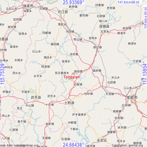
Tongxian GPS coordinates[2]
25° 18' 6.084" North, 116° 27' 23.076" East
| Map corner | latitude | longitude |
|---|---|---|
| Upper-left | 25.93569°, | 115.75329° |
| Center: | 25.30169°, | 116.45641° |
| Lower-right: | 24.66436°, | 117.15954° |
| Map W x H: | 141.4×141.4 km | = 87.9×87.9mi |
| max Lat: | 53.31946° ⇑85.1% North |
| Tongxian: | 25.30169° |
| min Lat: | ⇓14.9% South 18.22056° |
| min Long | Tongxian | max Long |
| 75.07348° | 116.45641° | 134.28917° |
| W 62.8%⇐ | ⇒37.2% E |
Elevation
Elevation of Tongxian is 315 m = 1033 ft, and this is 169.8 m = 557 ft below average elevation for this country.
| Max E: |
5622 m = 18445 ft | 35.7% |
| Avg. | 484.8 m = 1591 ft | |
| Tongxian | 315 m = 1033 ft | |
Min E: |
-3 m = -10 ft | 64.3% |
See also: China elevation on elevation.city.
Geographical zone
Tongxian is located in North temperate zone (between Tropic of Cancer and the Arctic Circle). Distance of this Northern Tropic circle is 207.4 km =128.9 mi to South.| Distance of | km | miles | from Tongxian |
|---|---|---|---|
| North Pole | 7193.8 | 4470 | to North |
| Arctic Circle | 4587.9 | 2850.8 | to North |
| Tropic Cancer | 207.4 | 128.9 | to South |
| Equator | 2813.3 | 1748.1 | to South |


Nearby cities:
15 places around Tongxian: (largest is in red/bold)
• Baisha
24 km =14.9 mi,  143°
143°
• Guanzhuang
11.3 km =7 mi,  274°
274°
• Jiuxian
9.6 km =6 mi,  154°
154°
• Lincheng
27.4 km =17 mi,  190°
190°
• Linjiang
28 km =17.4 mi, 187°
• Miaoqian
22.7 km =14.1 mi,  82°
82°
• Shangcai Zhongxing
5.8 km =3.6 mi,  223°
223°
• Shanhu
15.2 km =9.4 mi,  238°
238°
• Shaxiaba
5 km =3.1 mi,  62°
62°
• Taoxi
28 km =17.4 mi,  284°
284°
• Tufang
18.9 km =11.7 mi,  0°
0°
• Xinquan
16.7 km =10.4 mi,  69°
69°
• Xuancheng
14 km =8.7 mi,  328°
328°
• Yanggu
16.9 km =10.5 mi,  303°
303°
• Zhongbao
22.6 km =14 mi, 238°
Sources, notices
• [Note1] Compared only with cities in China existing in our database
• [Src1] Map data: © OpenStreetMap contributors (CC-BY-SA)
• [Src2] Other city data from geonames.org with taken over terms of usage.
• [Src3] Geographical zone / Annual Mean Temperature by Robert A. Rohde @ Wikipedia
