Yanggu geodata
Yanggu (Fujian) is a seat of a fourth-order administrative division; located in China in Asia/Shanghai (GMT+8) time zone. In our database, there are 1268 cities with bigger population. Compared to other cities in China, 84.8% of cities are located further ↑North; 61.9% of cities are located further ←West and 60.2% of cities have lower elevation than Yanggu. Note1


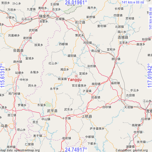
Yanggu GPS coordinates[2]
25° 23' 9.816" North, 116° 18' 58.644" East
| Map corner | latitude | longitude |
|---|---|---|
| Upper-left | 26.01961°, | 115.61317° |
| Center: | 25.38606°, | 116.31629° |
| Lower-right: | 24.74917°, | 117.01942° |
| Map W x H: | 141.3×141.3 km | = 87.8×87.8mi |
| max Lat: | 53.31946° ⇑84.8% North |
| Yanggu: | 25.38606° |
| min Lat: | ⇓15.2% South 18.22056° |
| min Long | Yanggu | max Long |
| 75.07348° | 116.31629° | 134.28917° |
| W 61.9%⇐ | ⇒38.1% E |
Elevation
Elevation of Yanggu is 261 m = 856 ft, and this is 223.8 m = 734 ft below average elevation for this country.
| Max E: |
5622 m = 18445 ft | 39.8% |
| Avg. | 484.8 m = 1591 ft | |
| Yanggu | 261 m = 856 ft | |
Min E: |
-3 m = -10 ft | 60.2% |
See also: China elevation on elevation.city.
Geographical zone
Yanggu is located in North temperate zone (between Tropic of Cancer and the Arctic Circle). Distance of this Northern Tropic circle is 216.7 km =134.7 mi to South.| Distance of | km | miles | from Yanggu |
|---|---|---|---|
| North Pole | 7184.4 | 4464.2 | to North |
| Arctic Circle | 4578.5 | 2844.9 | to North |
| Tropic Cancer | 216.7 | 134.7 | to South |
| Equator | 2822.7 | 1753.9 | to South |


Nearby cities:
15 places around Yanggu: (largest is in red/bold)
• Dahe
21.6 km =13.4 mi,  274°
274°
• Guanzhuang
9 km =5.6 mi,  161°
161°
• Hongshan
24.6 km =15.3 mi,  299°
299°
• Sanzhou
23.8 km =14.8 mi,  15°
15°
• Shangcai Zhongxing
16.9 km =10.5 mi,  143°
143°
• Shanhu
17.3 km =10.7 mi,  176°
176°
• Shaxiaba
19.8 km =12.3 mi,  110°
110°
• Taoxi
13.3 km =8.3 mi,  259°
259°
• Tongxian
16.9 km =10.5 mi,  123°
123°
• Tufang
17.1 km =10.6 mi,  56°
56°
• Xiangdian
12.5 km =7.8 mi, 300°
• Xuancheng
7.3 km =4.5 mi,  69°
69°
• Yongping
23.4 km =14.5 mi,  240°
240°
• Zhongbao
21.8 km =13.5 mi,  193°
193°
• Zhuotian
19.6 km =12.2 mi,  347°
347°
Sources, notices
• [Note1] Compared only with cities in China existing in our database
• [Src1] Map data: © OpenStreetMap contributors (CC-BY-SA)
• [Src2] Other city data from geonames.org with taken over terms of usage.
• [Src3] Geographical zone / Annual Mean Temperature by Robert A. Rohde @ Wikipedia
