Tongjing geodata
Tongjing (Chongqing) is a seat of a fourth-order administrative division; located in China in Asia/Shanghai (GMT+8) time zone. In our database, there are 1268 cities with bigger population. Compared to other cities in China, 55.6% of cities are located further ↑North; 84.1% of cities are located further →East and 54.1% of cities have lower elevation than Tongjing. Note1


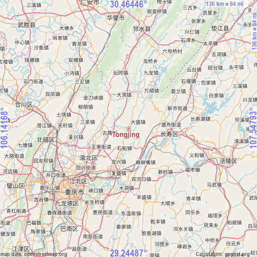
Tongjing GPS coordinates[2]
29° 51' 23.508" North, 106° 50' 41.28" East
| Map corner | latitude | longitude |
|---|---|---|
| Upper-left | 30.46446°, | 106.14168° |
| Center: | 29.85653°, | 106.8448° |
| Lower-right: | 29.24487°, | 107.54793° |
| Map W x H: | 135.6×135.6 km | = 84.3×84.3mi |
| max Lat: | 53.31946° ⇑55.6% North |
| Tongjing: | 29.85653° |
| min Lat: | ⇓44.4% South 18.22056° |
| min Long | Tongjing | max Long |
| 75.07348° | 106.8448° | 134.28917° |
| W 15.9%⇐ | ⇒84.1% E |
Elevation
Elevation of Tongjing is 198 m = 650 ft, and this is 286.8 m = 941 ft below average elevation for this country.
| Max E: |
5622 m = 18445 ft | 45.9% |
| Avg. | 484.8 m = 1591 ft | |
| Tongjing | 198 m = 650 ft | |
Min E: |
-3 m = -10 ft | 54.1% |
See also: China elevation on elevation.city.
Geographical zone
Tongjing is located in North temperate zone (between Tropic of Cancer and the Arctic Circle). Distance of this Northern Tropic circle is 713.8 km =443.5 mi to South.| Distance of | km | miles | from Tongjing |
|---|---|---|---|
| North Pole | 6687.3 | 4155.3 | to North |
| Arctic Circle | 4081.4 | 2536.1 | to North |
| Tropic Cancer | 713.8 | 443.5 | to South |
| Equator | 3319.7 | 2062.8 | to South |


Nearby cities:
15 places around Tongjing: (largest is in red/bold)
• Bake
17.9 km =11.1 mi,  74°
74°
• Cizhu
17.5 km =10.9 mi,  324°
324°
• Dasheng
6.3 km =3.9 mi,  53°
53°
• Dawan
18.3 km =11.4 mi,  352°
352°
• Duzhou
22.7 km =14.1 mi,  83°
83°
• Fengcheng
21.4 km =13.3 mi,  98°
98°
• Gulu
10.1 km =6.3 mi,  258°
258°
• Honghu
19 km =11.8 mi,  32°
32°
• Jiangnan
19.8 km =12.3 mi,  110°
110°
• Longxing
17.9 km =11.1 mi,  196°
196°
• Luoqi
18 km =11.2 mi,  151°
151°
• Maliuzui
20.6 km =12.8 mi, 152°
• Mu’er
20.1 km =12.5 mi,  253°
253°
• Shichuan
10.3 km =6.4 mi,  191°
191°
• Xinglong
13.8 km =8.6 mi,  285°
285°
Sources, notices
• [Note1] Compared only with cities in China existing in our database
• [Src1] Map data: © OpenStreetMap contributors (CC-BY-SA)
• [Src2] Other city data from geonames.org with taken over terms of usage.
• [Src3] Geographical zone / Annual Mean Temperature by Robert A. Rohde @ Wikipedia
