Tiebiancheng geodata
Tiebiancheng (Shaanxi) is a seat of a fourth-order administrative division; located in China in Asia/Shanghai (GMT+8) time zone. In our database, there are 1268 cities with bigger population. Compared to other cities in China, 79.2% of cities are located further ↓South; 81.1% of cities are located further →East and 90.5% of cities have lower elevation than Tiebiancheng. Note1


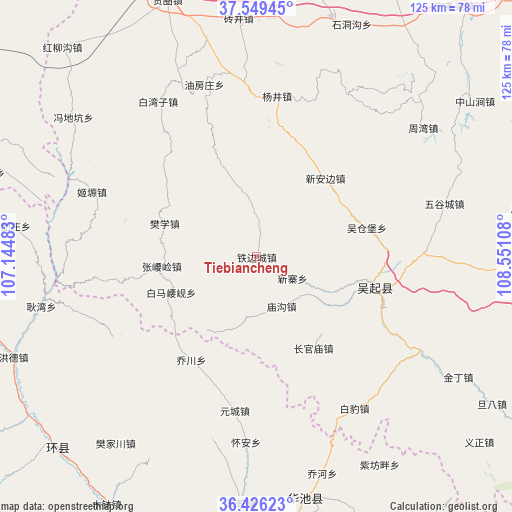
Tiebiancheng GPS coordinates[2]
36° 59' 23.676" North, 107° 50' 52.62" East
| Map corner | latitude | longitude |
|---|---|---|
| Upper-left | 37.54945°, | 107.14483° |
| Center: | 36.98991°, | 107.84795° |
| Lower-right: | 36.42623°, | 108.55108° |
| Map W x H: | 124.9×124.9 km | = 77.6×77.6mi |
| max Lat: | 53.31946° ⇑20.8% North |
| Tiebiancheng: | 36.98991° |
| min Lat: | ⇓79.2% South 18.22056° |
| min Long | Tiebiancheng | max Long |
| 75.07348° | 107.84795° | 134.28917° |
| W 18.9%⇐ | ⇒81.1% E |
Elevation
Elevation of Tiebiancheng is 1405 m = 4610 ft, and this is 920.2 m = 3019 ft above average elevation for this country.
| Max E: |
5622 m = 18445 ft | 9.5% |
| Tiebiancheng | 1405 m 4610 ft | |
| Avg. | 484.8 m = 1591 ft | |
Min E: |
-3 m = -10 ft | 90.5% |
See also: China elevation on elevation.city.
Geographical zone
Tiebiancheng is located in North temperate zone (between Tropic of Cancer and the Arctic Circle). Distance of this Northern Tropic circle is 1507 km =936.4 mi to South.| Distance of | km | miles | from Tiebiancheng |
|---|---|---|---|
| North Pole | 5894.2 | 3662.5 | to North |
| Arctic Circle | 3288.3 | 2043.3 | to North |
| Tropic Cancer | 1507 | 936.4 | to South |
| Equator | 4112.9 | 2555.6 | to South |


Nearby cities:
15 places around Tiebiancheng: (largest is in red/bold)
• Baima
45.2 km =28.1 mi,  193°
193°
• Bazhu
54.2 km =33.7 mi,  206°
206°
• Fanjiachuan
57.2 km =35.5 mi,  217°
217°
• Gengwan
53.8 km =33.4 mi,  257°
257°
• Hongde
65.2 km =40.5 mi,  244°
244°
• Huai’an
45.3 km =28.1 mi,  183°
183°
• Miaogou
13.6 km =8.5 mi,  153°
153°
• Miaoxiang
52.8 km =32.8 mi,  166°
166°
• Qiaochuan
29.7 km =18.5 mi, 212°
• Rouyuan
60 km =37.3 mi, 168°
• Siheyuan
43 km =26.7 mi,  249°
249°
• Wujiao
60.2 km =37.4 mi, 183°
• Wuqi
29.6 km =18.4 mi,  103°
103°
• Xinzhai
10.3 km =6.4 mi,  120°
120°
• Yuancheng
37.9 km =23.5 mi, 187°
Sources, notices
• [Note1] Compared only with cities in China existing in our database
• [Src1] Map data: © OpenStreetMap contributors (CC-BY-SA)
• [Src2] Other city data from geonames.org with taken over terms of usage.
• [Src3] Geographical zone / Annual Mean Temperature by Robert A. Rohde @ Wikipedia
