Taosi geodata
Taosi (Shanxi) is a seat of a fourth-order administrative division; located in China in Asia/Shanghai (GMT+8) time zone. In our database, there are 1268 cities with bigger population. Compared to other cities in China, 77% of cities are located further ↓South; 65% of cities are located further →East and 75% of cities have lower elevation than Taosi. Note1


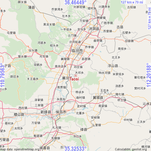
Taosi GPS coordinates[2]
35° 53' 49.056" North, 111° 29' 55.5" East
| Map corner | latitude | longitude |
|---|---|---|
| Upper-left | 36.46449°, | 110.79563° |
| Center: | 35.89696°, | 111.49875° |
| Lower-right: | 35.32533°, | 112.20188° |
| Map W x H: | 126.7×126.7 km | = 78.7×78.7mi |
| max Lat: | 53.31946° ⇑23% North |
| Taosi: | 35.89696° |
| min Lat: | ⇓77% South 18.22056° |
| min Long | Taosi | max Long |
| 75.07348° | 111.49875° | 134.28917° |
| W 35%⇐ | ⇒65% E |
Elevation
Elevation of Taosi is 522 m = 1713 ft, and this is 37.2 m = 122 ft above average elevation for this country.
| Max E: |
5622 m = 18445 ft | 25% |
| Taosi | 522 m 1713 ft | |
| Avg. | 484.8 m = 1591 ft | |
Min E: |
-3 m = -10 ft | 75% |
See also: China elevation on elevation.city.
Geographical zone
Taosi is located in North temperate zone (between Tropic of Cancer and the Arctic Circle). Distance of this Northern Tropic circle is 1385.4 km =860.8 mi to South.| Distance of | km | miles | from Taosi |
|---|---|---|---|
| North Pole | 6015.7 | 3738 | to North |
| Arctic Circle | 3409.8 | 2118.8 | to North |
| Tropic Cancer | 1385.4 | 860.8 | to South |
| Equator | 3991.4 | 2480.1 | to South |


Nearby cities:
15 places around Taosi: (largest is in red/bold)
• Dadeng
4.2 km =2.6 mi,  49°
49°
• Dengzhuang
7.8 km =4.8 mi,  15°
15°
• Fencheng
22.1 km =13.7 mi,  246°
246°
• Gaoxian
21 km =13 mi,  199°
199°
• Gucheng
16.2 km =10.1 mi,  275°
275°
• Jingmao
13 km =8.1 mi,  262°
262°
• Licun
15.7 km =9.8 mi,  194°
194°
• Linfen
21.4 km =13.3 mi,  4°
4°
• Nanjia
15.2 km =9.4 mi,  231°
231°
• Nanxindian
14.9 km =9.3 mi,  302°
302°
• Qucun
18.7 km =11.6 mi,  167°
167°
• Xiangling
17 km =10.6 mi,  328°
328°
• Xijia
18.5 km =11.5 mi,  237°
237°
• Xincheng
6.2 km =3.9 mi, 246°
• Yangtan
14 km =8.7 mi, 165°
Sources, notices
• [Note1] Compared only with cities in China existing in our database
• [Src1] Map data: © OpenStreetMap contributors (CC-BY-SA)
• [Src2] Other city data from geonames.org with taken over terms of usage.
• [Src3] Geographical zone / Annual Mean Temperature by Robert A. Rohde @ Wikipedia
