Tancheng geodata
Tancheng (Shandong) is a seat of a third-order administrative division; located in China in Asia/Shanghai (GMT+8) time zone. In our database, there are 1268 cities with bigger population. Compared to other cities in China, 73.3% of cities are located further ↓South; 72.2% of cities are located further ←West and 73.3% of cities have higher elevation than Tancheng. Note1


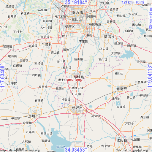
Tancheng GPS coordinates[2]
34° 36' 54.72" North, 118° 20' 16.8" East
| Map corner | latitude | longitude |
|---|---|---|
| Upper-left | 35.19184°, | 117.63488° |
| Center: | 34.6152°, | 118.338° |
| Lower-right: | 34.03453°, | 119.04113° |
| Map W x H: | 128.7×128.7 km | = 80×80mi |
| max Lat: | 53.31946° ⇑26.7% North |
| Tancheng: | 34.6152° |
| min Lat: | ⇓73.3% South 18.22056° |
| min Long | Tancheng | max Long |
| 75.07348° | 118.338° | 134.28917° |
| W 72.2%⇐ | ⇒27.8% E |
Elevation
Elevation of Tancheng is 41 m = 135 ft, and this is 443.8 m = 1456 ft below average elevation for this country.
| Max E: |
5622 m = 18445 ft | 73.3% |
| Avg. | 484.8 m = 1591 ft | |
| Tancheng | 41 m = 135 ft | |
Min E: |
-3 m = -10 ft | 26.7% |
See also: China elevation on elevation.city.
Geographical zone
Tancheng is located in North temperate zone (between Tropic of Cancer and the Arctic Circle). Distance of this Northern Tropic circle is 1242.9 km =772.3 mi to South.| Distance of | km | miles | from Tancheng |
|---|---|---|---|
| North Pole | 6158.2 | 3826.5 | to North |
| Arctic Circle | 3552.3 | 2207.3 | to North |
| Tropic Cancer | 1242.9 | 772.3 | to South |
| Equator | 3848.8 | 2391.5 | to South |


Nearby cities:
15 places around Tancheng: (largest is in red/bold)
• Bianzhuang
37.3 km =23.2 mi,  314°
314°
• Dunshang
64.9 km =40.3 mi,  80°
80°
• Gaoxu
69 km =42.9 mi,  117°
117°
• Haizhou
72.5 km =45 mi,  92°
92°
• Jinping
72.1 km =44.8 mi,  98°
98°
• Linyi
49.8 km =30.9 mi,  0°
0°
• Longju
75.1 km =46.7 mi,  111°
111°
• Luoyang
71.1 km =44.2 mi, 81°
• Niushan
40.4 km =25.1 mi, 104°
• Pizhou
49 km =30.4 mi,  226°
226°
• Qingkou
75 km =46.6 mi,  69°
69°
• Shucheng
68.3 km =42.4 mi,  143°
143°
• Xiazhuang
43.3 km =26.9 mi,  39°
39°
• Xinba
75.2 km =46.7 mi, 104°
• Xinpu
75.2 km =46.7 mi, 91°
Sources, notices
• [Note1] Compared only with cities in China existing in our database
• [Src1] Map data: © OpenStreetMap contributors (CC-BY-SA)
• [Src2] Other city data from geonames.org with taken over terms of usage.
• [Src3] Geographical zone / Annual Mean Temperature by Robert A. Rohde @ Wikipedia
